

| Mesoscale Discussion 2325 | |
| < Previous MD | |

|
|
   Mesoscale Discussion 2325
   NWS Storm Prediction Center Norman OK
   0334 PM CDT Tue Sep 22 2026

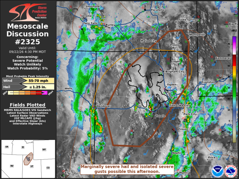
   Areas affected...Northern Utah into southeast Idaho

   Concerning...Severe potential...Watch unlikely

   Valid 222034Z - 222230Z

   Probability of Watch Issuance...5 percent

   SUMMARY...Marginally severe hail and isolated severe gusts are
   possible this afternoon. Overall severe coverage should remain too
   limited for a watch.

   DISCUSSION...A compact upper low is evident on water vapor imagery
   along northern portions of the Utah/Nevada border. Lift from this
   feature is promoting scattered convection across northern/eastern
   portions of the Great Basin this afternoon. Some activity near the
   Great Salt Lake has intensified during the last half hour. With
   additional heating, other storms may similarly increase in strength.
   The strongest shear exists in eastern Utah/western Colorado where
   the mid-level jet core is located. However, these areas have
   remained cooler/less unstable. Severe potential will likely be
   maximized along the northwest periphery of the mid-level jet where
   MLCAPE has risen to 500-750 J/kg. Temperatures near the upper low
   are cold enough to support marginally severe hail despite weaker
   shear. Isolated severe gusts are also possible.

   ..Wendt/Mosier.. 09/22/2026

   ...Please see www.spc.noaa.gov for graphic product...

   ATTN...WFO...SLC...PIH...

   LAT...LON   39891274 39921351 40691376 41561318 42441190 42471152
               42181130 41251136 40121240 39891274

   MOST PROBABLE PEAK WIND GUST...55-70 MPH
   MOST PROBABLE PEAK HAIL SIZE...UP TO 1.25 IN
|
|
|
Top/All Mesoscale Discussions/Forecast Products/Home |
|
Source link