

| Mesoscale Discussion 2303 | |
| < Previous MD | |

|
|
   Mesoscale Discussion 2303
   NWS Storm Prediction Center Norman OK
   0353 PM CDT Wed Sep 16 2026

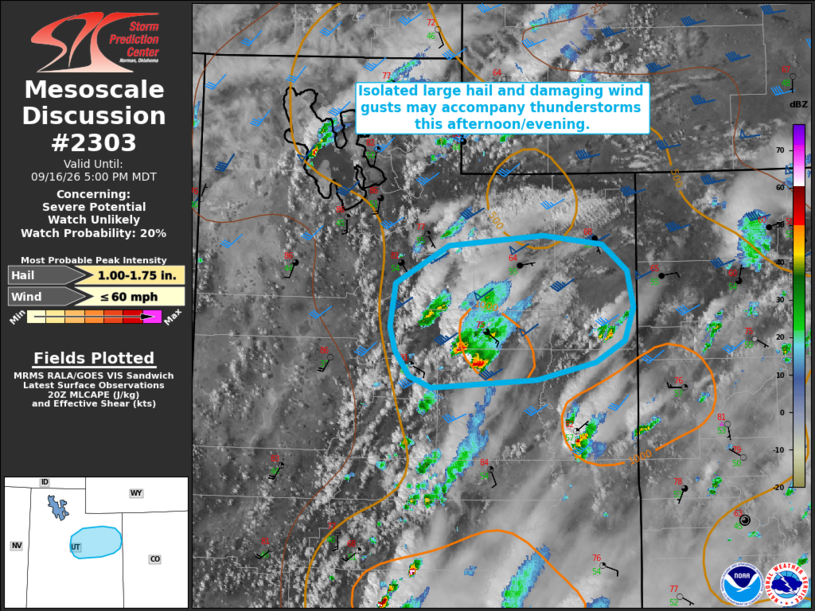
   Areas affected...portions of northeastern Utah

   Concerning...Severe potential...Watch unlikely

   Valid 162053Z - 162300Z

   Probability of Watch Issuance...20 percent

   SUMMARY...Isolated to widely scattered thunderstorms will bring a
   chance for occasional large hail and damaging wind gusts. Watch
   issuance is unlikely.

   DISCUSSION...Regional radar imagery depicts a developing supercell
   across portions of central/northeastern Utah. While available
   buoyancy remains relatively modest (generally 500-1000 J/kg MLCAPE),
   strong upper-level flow is contributing to effective shear of 40-50
   kts, which will continue to support a supercellular storm mode as
   convection evolves eastward through this evening. The primary risk
   with this activity will be large hail owing to elongated, relatively
   straight hodographs; however, mid-level lapse rates remain somewhat
   modest (around 7 C/km), which should temper the overall magnitude of
   the large hail threat. Isolated damaging/severe wind gusts are also
   possible, especially with any stronger downdrafts and/or evolving
   clusters. The overall magnitude and spatial extent of the severe
   risk are expected to remain too limited to warrant watch issuance,
   however.

   ..Chalmers/Thompson.. 09/16/2026

   ...Please see www.spc.noaa.gov for graphic product...

   ATTN...WFO...GJT...SLC...

   LAT...LON   39121136 39221161 39451177 39661184 40031177 40361117
               40461010 40370944 40150916 39830909 39540918 39340951
               39191018 39121136

   MOST PROBABLE PEAK WIND GUST...UP TO 60 MPH
   MOST PROBABLE PEAK HAIL SIZE...1.00-1.75 IN
|
|
|
Top/All Mesoscale Discussions/Forecast Products/Home |
|
Source link