

| Mesoscale Discussion 2077 | |
| < Previous MD | |

|
|
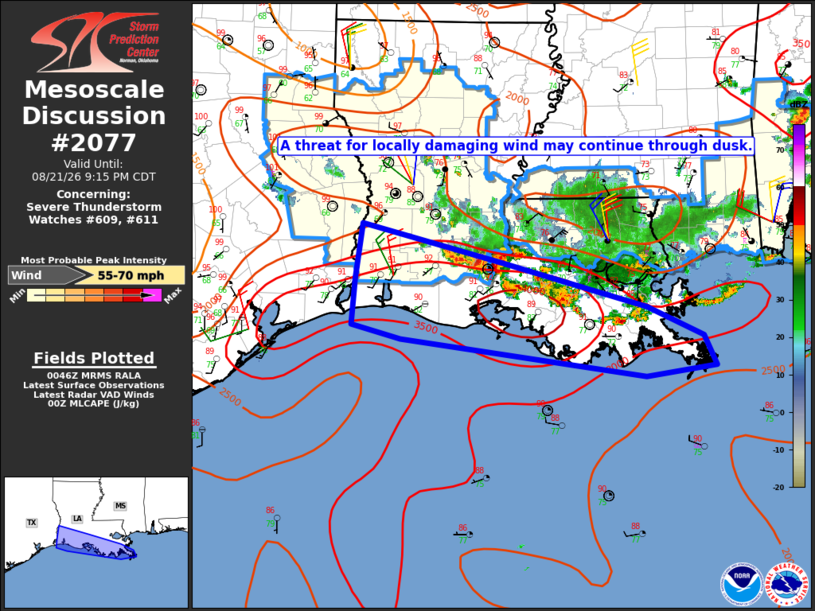
Mesoscale Discussion 2077 NWS Storm Prediction Center Norman OK 0749 PM CDT Fri Aug 21 2026 Areas affected...Parts of southern LA Concerning...Severe Thunderstorm Watch 609...611... Valid 220049Z - 220215Z The severe weather threat for Severe Thunderstorm Watch 609, 611 continues. SUMMARY...A threat for locally damaging wind may continue through dusk. DISCUSSION...Vigorous convection is spreading south-southwestward across southern LA this evening. Deep-layer flow/shear is weak, but very rich moisture (with 0-1 km mean mixing ratios of 20+ g/kg and PW well above 2 inches) and large MLCAPE of 3000-5000 J/kg (as observed on the LCH sounding) will continue to support a threat of at least localized wind damage, until storms weaken or move offshore later this evening. Some severe threat will spread south of ongoing watches, but the limited spatiotemporal extent of the remaining threat should preclude additional watch issuance. ..Dean.. 08/22/2026 ...Please see www.spc.noaa.gov for graphic product... ATTN...WFO...LIX...LCH... LAT...LON 30709361 30279182 29768990 29438917 29088902 28968992 29409311 29559375 30079371 30709361 MOST PROBABLE PEAK WIND GUST...55-70 MPH |
|
|
Top/All Mesoscale Discussions/Forecast Products/Home |
|
Source link