

| Mesoscale Discussion 2034 | |
| < Previous MD | |
|
|
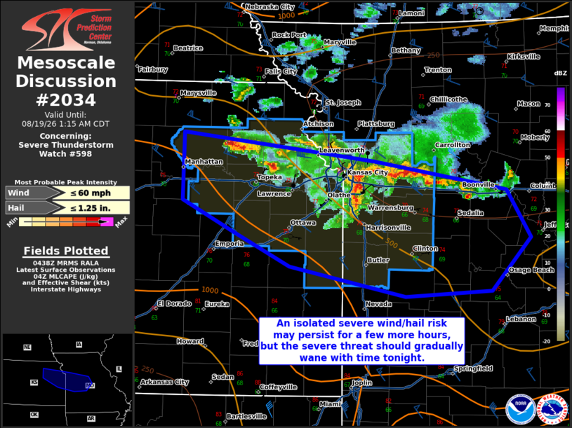
Mesoscale Discussion 2034 NWS Storm Prediction Center Norman OK 1140 PM CDT Tue Aug 18 2026 Areas affected...portions of eastern Kansas and western Missouri Concerning...Severe Thunderstorm Watch 598... Valid 190440Z - 190615Z The severe weather threat for Severe Thunderstorm Watch 598 continues. SUMMARY...A severe threat persists along the KS/MO border. However, the threat should gradually decrease through the evening with strengthening convective inhibition. DISCUSSION...A loosely organized MCS continues across northeast KS into western MO. While a few reports of marginally severe hail have been received with cells on the western flank of this MCS, the gusts over the past hour or so have remained below severe limits. As temperatures continue to further cool into the 70s F, boundary-layer decoupling and MLCINH should only increase with time, further diminishing the severe wind threat. A couple of the stronger cells may still pose a hail threat, but severe hail should remain more isolated into the evening hours. Given current severe trends, a downstream WW issuance appears unlikely at this time. ..Squitieri.. 08/19/2026 ...Please see www.spc.noaa.gov for graphic product... ATTN...WFO...LSX...SGF...EAX...TOP... LAT...LON 39519656 39249422 38969260 38509232 38009279 37949385 38239525 38569593 38879656 39519656 MOST PROBABLE PEAK WIND GUST...UP TO 60 MPH MOST PROBABLE PEAK HAIL SIZE...UP TO 1.25 IN |
|
|
Top/All Mesoscale Discussions/Forecast Products/Home |
|
Source link