

| Mesoscale Discussion 2022 | |
| < Previous MD | |

|
|
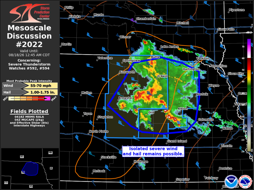
Mesoscale Discussion 2022 NWS Storm Prediction Center Norman OK 1121 PM CDT Mon Aug 17 2026 Areas affected...portions of central and eastern Nebraska Concerning...Severe Thunderstorm Watch 592...594... Valid 180421Z - 180545Z The severe weather threat for Severe Thunderstorm Watch 592, 594 continues. SUMMARY...A brief bout of severe hail or a gust may still occur with one of the stronger embedded cells within the broader thunderstorm cluster. However, the overall severe threat should diminish with time tonight. DISCUSSION...A loosely organized MCS continues to propagate eastward as cold pools with surrounding supercells and multicells merge. 04Z mesoanalysis depicts increasing MLCINH, indicating a gradually decoupling boundary layer. Ongoing storms should continue to become progressively elevated with time, which will further limit the severe threat. In the next 1-2 hours though, isolated severe hail or wind may accompany the stronger storm cores given over 2000 J/kg MUCAPE and 40+ kts of effective bulk shear in place. ..Squitieri.. 08/18/2026 ...Please see www.spc.noaa.gov for graphic product... ATTN...WFO...FSD...OAX...GID...LBF... LAT...LON 41810017 42449966 42819939 42949849 42829783 42619730 42019729 41429742 41209772 41159845 41199910 41329945 41810017 MOST PROBABLE PEAK WIND GUST...55-70 MPH MOST PROBABLE PEAK HAIL SIZE...1.00-1.75 IN |
|
|
Top/All Mesoscale Discussions/Forecast Products/Home |
|
Source link