

| Mesoscale Discussion 1986 | |
| < Previous MD Next MD > | |

|
|
   Mesoscale Discussion 1986
   NWS Storm Prediction Center Norman OK
   1225 PM CDT Sat Aug 15 2026

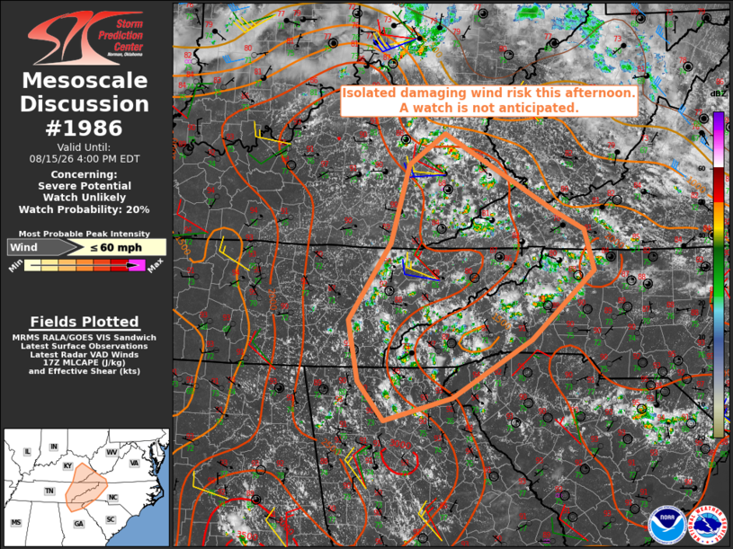
   Areas affected...Cumberland Plateau into the Blue Ridge...including
   the Great Smoky Mountains

   Concerning...Severe potential...Watch unlikely

   Valid 151725Z - 152000Z

   Probability of Watch Issuance...20 percent

   SUMMARY...Isolated occurrences of locally damaging winds appear
   possible with the strongest storms this afternoon. The areal
   coverage of the threat is expected to remain too limited to warrant
   a watch issuance.

   DISCUSSION...Visible satellite and radar imagery indicate a gradual
   increase in thunderstorm activity early this afternoon from the
   Cumberland Plateau into the Blue Ridge, including the Great Smoky
   Mountains. In the absence of appreciable forcing for ascent, it
   appears daytime heating of a moist and moderately to strongly
   unstable air mass (MLCAPE of 1500-3000 J/kg - per latest objective
   analysis) is contributing to this development. Regional VWPs
   indicate rather weak vertical shear, which should limit the degree
   of storm organization with pulse-type storm modes expected.
   Nonetheless, isolated occurrences of locally damaging winds appear
   possible with the strongest storms, owing to the potential for
   effective water loading of convective downdrafts.

   ..Mead/Guyer.. 08/15/2026

   ...Please see www.spc.noaa.gov for graphic product...

   ATTN...WFO...RNK...RLX...GSP...MRX...JKL...FFC...OHX...

   LAT...LON   35628489 36668420 37718390 38148331 37088146 36838099
               36298083 35358187 34588318 34278430 34808474 35628489

   MOST PROBABLE PEAK WIND GUST...UP TO 60 MPH
|
|
|
Top/All Mesoscale Discussions/Forecast Products/Home |
|
Source link