

| Mesoscale Discussion 1983 | |
| < Previous MD | |
|
|
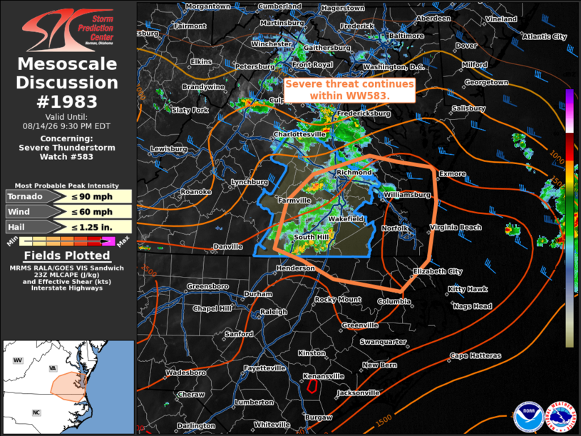
Mesoscale Discussion 1983 NWS Storm Prediction Center Norman OK 0655 PM CDT Fri Aug 14 2026 Areas affected...portions of eastern Virginia into northern North Carolina Concerning...Severe Thunderstorm Watch 583... Valid 142355Z - 150130Z The severe weather threat for Severe Thunderstorm Watch 583 continues. SUMMARY...Severe potential continues within WW583. DISCUSSION...Thunderstorms continue south and eastward within WW583. These have shown a gradual weakening trend but will continue to pose some risk for strong to severe wind in the near term given the hot and unstable environment downstream. Further weakening is expected with loss of daytime heating and movement into a region with less shear for organization occurs in the next hour. As such, downstream watch issuance is not expected. ..Thornton.. 08/14/2026 ...Please see www.spc.noaa.gov for graphic product... ATTN...WFO...AKQ...RAH... LAT...LON 37827690 37587781 37257821 36637840 36487796 36267747 36097642 36497597 37227584 37627587 37677593 37747646 37827690 MOST PROBABLE PEAK TORNADO INTENSITY...UP TO 90 MPH MOST PROBABLE PEAK WIND GUST...UP TO 60 MPH MOST PROBABLE PEAK HAIL SIZE...UP TO 1.25 IN |
|
|
Top/All Mesoscale Discussions/Forecast Products/Home |
|
Source link