

| Mesoscale Discussion 1962 | |
| < Previous MD | |
|
|
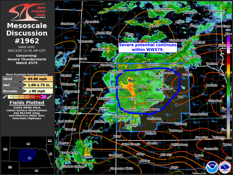
Mesoscale Discussion 1962 NWS Storm Prediction Center Norman OK 1050 PM CDT Wed Aug 12 2026 Areas affected...central Nebraska Concerning...Severe Thunderstorm Watch 579... Valid 130350Z - 130545Z The severe weather threat for Severe Thunderstorm Watch 579 continues. SUMMARY...Severe potential continues within WW579. DISCUSSION...A slow moving cluster of thunderstorms continues to evolve eastward along north/south combining outflow boundaries. Occasional gusts of 50-60 mph have been reported. Ahead of the ongoing convection, a precipitation shield has developed. Nocturnal cooling and increasing MLCIN are noted ahead of the line across central Nebraska. Nonetheless, 00z observed sounding from OAX would suggest that appreciable MUCAPE is available downstream. VAD profiles across Oklahoma and Kansas are starting to sample the increasing 30-35 kt southerly low-level jet (LLJ). This is forecast to further increase and nudge into portions of southern Nebraska over the next couple of hours. Hi-res and ensemble guidance continue to suggest that some increase in intensity of convection will be possible as this occurs, with potential for damaging wind to continue across central Nebraska after 06z. ..Thornton.. 08/13/2026 ...Please see www.spc.noaa.gov for graphic product... ATTN...WFO...GID...LBF... LAT...LON 42730113 42720166 42430208 41690206 41230187 41070139 41020026 41239964 41949880 42529875 42809940 42809990 42730113 MOST PROBABLE PEAK TORNADO INTENSITY...UP TO 90 MPH MOST PROBABLE PEAK WIND GUST...65-80 MPH MOST PROBABLE PEAK HAIL SIZE...1.00-1.75 IN |
|
|
Top/All Mesoscale Discussions/Forecast Products/Home |
|
Source link