

| Mesoscale Discussion 1958 | |
| < Previous MD | |

|
|
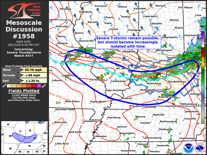
Mesoscale Discussion 1958 NWS Storm Prediction Center Norman OK 0433 PM CDT Wed Aug 12 2026 Areas affected...Eastern Missouri into the lower Ohio River Valley Concerning...Severe Thunderstorm Watch 577... Valid 122133Z - 122330Z The severe weather threat for Severe Thunderstorm Watch 577 continues. SUMMARY...Severe thunderstorms will continue to pose a severe wind and hail threat for the next hour or two, but should become increasingly sporadic through the evening hours. Downstream watch issuance will most likely not be required. DISCUSSION...The remnants of an MCS continue to push southward across the lower OH Valley, and although storm mode has become increasingly disorganized and outflow-dominant (likely a consequence of diminishing deep-layer wind shear with southward extent), lightning counts have increased over the past 20 minutes within a few cells from eastern MO into far southwest IN. This uptick in intensity comes as convection begins to push into a regional buoyancy maximum where MLCAPE was recently analyzed to be around 3500 J/kg. Consequently, the potential for large hail (most likely around one inch) and strong/severe downburst winds should linger for the next 1-2 hours as convection migrates through the best thermodynamic environment. However, regional reflectivity/velocity imagery shows that much of this activity is quickly becoming displaced behind a coherent convective outflow and/or has storm motions into the cold pool. Weaker deep-layer wind shear with southward extent should maintain the outflow-dominant nature of the convection and will eventually promote storm weakening and an increasingly isolated severe threat heading into the mid/late evening. Latest HRRR/RRFS time-lagged guidance captures this trend well and suggests the severe threat may not extend much beyond the southern bounds of WW 577. While convective trends will continue to be monitored as storms push through the buoyancy maximum, downstream watch issuance is currently not anticipated. ..Moore.. 08/12/2026 ...Please see www.spc.noaa.gov for graphic product... ATTN...WFO...ILN...LMK...PAH...LSX... LAT...LON 39249129 39119068 38508854 38308798 38258739 38288658 38408591 38598501 38698461 38718427 38588405 38378397 38108412 37808448 37418501 37138549 36858595 36768634 36728676 36718730 36778790 36858841 36988909 37228976 37459026 37749081 38019124 38249156 38529182 38719193 39129174 39249129 MOST PROBABLE PEAK TORNADO INTENSITY...UP TO 90 MPH MOST PROBABLE PEAK WIND GUST...55-70 MPH MOST PROBABLE PEAK HAIL SIZE...UP TO 1.25 IN |
|
|
Top/All Mesoscale Discussions/Forecast Products/Home |
|
Source link