

| Mesoscale Discussion 1909 | |
| < Previous MD | |

|
|
   Mesoscale Discussion 1909
   NWS Storm Prediction Center Norman OK
   0700 PM CDT Mon Aug 10 2026

   Areas affected...Parts of northern NY/VT

   Concerning...Severe potential...Watch unlikely

   Valid 110000Z - 110130Z

   Probability of Watch Issuance...20 percent

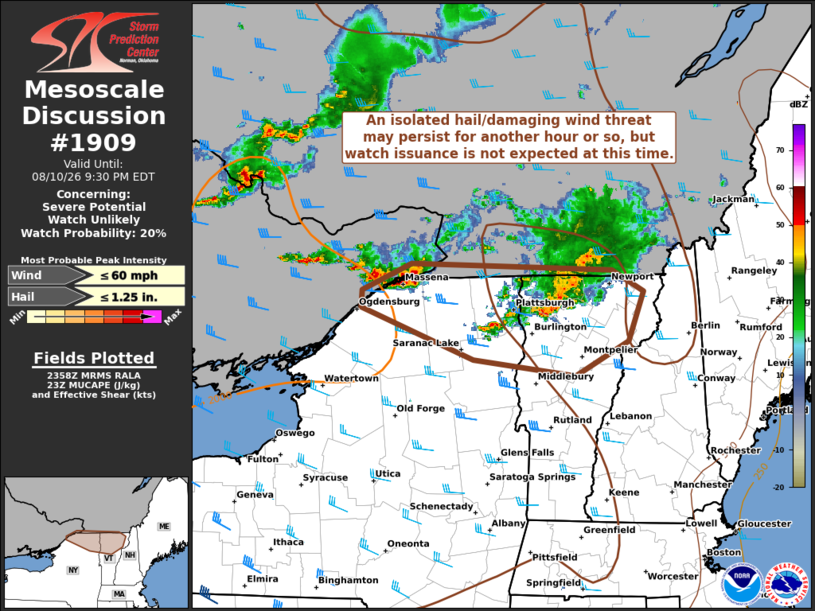
   SUMMARY...An isolated hail/damaging wind threat may persist for
   another hour or so, but watch issuance is not expected at this time.

   DISCUSSION...On the southern periphery of large-scale upper
   troughing over Ontario/Quebec, isolated thunderstorms have recently
   strengthened/moved into northern NY/VT. Favorable deep-layer shear
   (up to 40-45 kt) noted on the latest VWP from KCXX should continue
   to support updraft organization in the short term, with a small
   cluster moving across northern VT capable of producing damaging
   winds. Farther west, a cell moving into far northern NY may also
   pose an isolated threat for hail and gusty winds. However, the
   airmass across these areas is not overly unstable, and the loss of
   daytime heating should result in gradual stabilization of the
   boundary layer and an eventual weakening to ongoing thunderstorms.
   Therefore, watch issuance appears unlikely.

   ..Gleason/Mosier.. 08/11/2026

   ...Please see www.spc.noaa.gov for graphic product...

   ATTN...WFO...BTV...

   LAT...LON   44867542 45117478 45057217 44857175 44407196 44087264
               44227396 44707542 44867542

   MOST PROBABLE PEAK WIND GUST...UP TO 60 MPH
   MOST PROBABLE PEAK HAIL SIZE...UP TO 1.25 IN
|
|
|
Top/All Mesoscale Discussions/Forecast Products/Home |
|
Source link