

| Mesoscale Discussion 1901 | |
| < Previous MD | |

|
|
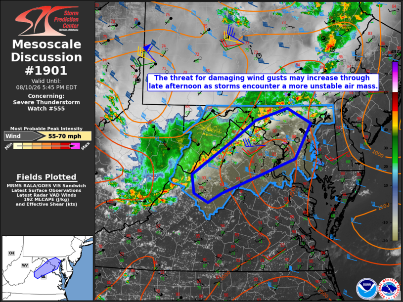
Mesoscale Discussion 1901 NWS Storm Prediction Center Norman OK 0239 PM CDT Mon Aug 10 2026 Areas affected...central and eastern Maryland into northern Virginia Concerning...Severe Thunderstorm Watch 555... Valid 101939Z - 102145Z The severe weather threat for Severe Thunderstorm Watch 555 continues. SUMMARY...The threat for damaging wind gusts may increase through late afternoon as the ongoing storms encounter a more unstable air mass. DISCUSSION...Strong to potentially severe storms currently emerging from the Blue Ridge Mountains are moving into a hotter and more unstable air mass, characterized by MLCAPE of 2000-2500 J/kg and 0-3 km lapse rates of around 8 C/km. Moreover, The KLWX VWP is sampling strengthening westerly winds above 3.5 km AGL, which may aid in storm organization. The extent of the damaging wind threat will be dependent on the degree of cold-pool organization that can occur. However, the more favorable parameter space with eastward extent suggests that threat should increase through late afternoon. ..Mead.. 08/10/2026 ...Please see www.spc.noaa.gov for graphic product... ATTN...WFO...LWX... LAT...LON 38397926 39067824 39447771 39667692 39387634 38697674 38047853 37867887 38037920 38397926 MOST PROBABLE PEAK WIND GUST...55-70 MPH |
|
|
Top/All Mesoscale Discussions/Forecast Products/Home |
|
Source link