

| Mesoscale Discussion 1894 | |
| < Previous MD | |

|
|
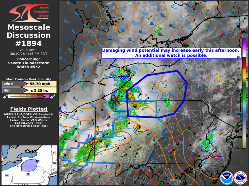
Mesoscale Discussion 1894 NWS Storm Prediction Center Norman OK 1044 AM CDT Mon Aug 10 2026 Areas affected...western into central New York and north-central Pennsylvania Concerning...Severe Thunderstorm Watch 552... Valid 101544Z - 101745Z The severe weather threat for Severe Thunderstorm Watch 552 continues. SUMMARY...Damaging wind potential may increase early this afternoon with storms located immediately ahead of an MCV. An additional downstream watch may become necessary. DISCUSSION...Ahead of a well-defined MCV, a broken band of thunderstorms has persisted this morning across portions of western NY and northwest PA. Considerable cloud cover has limited daytime heating and resultant air mass destabilization so far today. However, thinner clouds are allowing for stronger daytime heating across portions of central NY into north-central PA, which should allow for greater destabilization to occur with steepening low-level lapse rates. Dynamic forcing associated with the MCV is likely to sustain ongoing storms, which may intensify as they continue east and encounter an increasingly unstable environment. Earlier VWP observations near Cleveland, OH and current storm motions of around 40 kt are suggestive of a belt of enhanced westerly flow, generally in the 1-4 km layer, which coupled with steepening low-level lapse rates, may support an increased potential for damaging wind gusts early this afternoon. ..Mead/Hart.. 08/10/2026 ...Please see www.spc.noaa.gov for graphic product... ATTN...WFO...BGM...BUF...CTP...PBZ... LAT...LON 41437896 42177902 42337904 42937804 43097654 42637608 41987624 41527674 41387745 41437896 MOST PROBABLE PEAK WIND GUST...55-70 MPH MOST PROBABLE PEAK HAIL SIZE...UP TO 1.25 IN |
|
|
Top/All Mesoscale Discussions/Forecast Products/Home |
|
Source link