

| Mesoscale Discussion 1890 | |
| < Previous MD | |

|
|
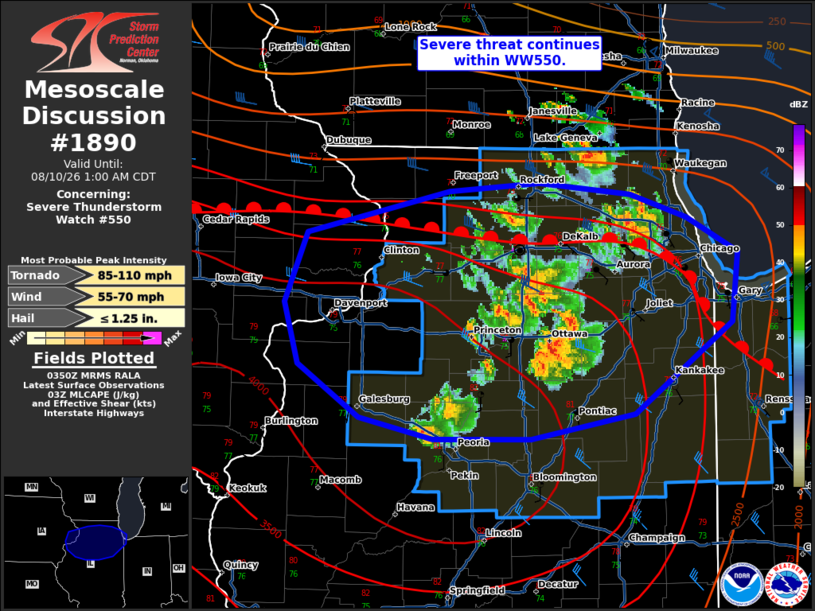
Mesoscale Discussion 1890 NWS Storm Prediction Center Norman OK 1053 PM CDT Sun Aug 09 2026 Areas affected...northern Illinois Concerning...Severe Thunderstorm Watch 550... Valid 100353Z - 100600Z The severe weather threat for Severe Thunderstorm Watch 550 continues. SUMMARY...Severe potential continues within WW550. DISCUSSION...Supercells and supercell hybrid clusters continue across portions of northern Illinois. As the low-level jet has strengthened, a few low topped supercells have shown weak rotation. One supercell in Lee County near the warm front/outflow boundary across northern Illinois approached 60 kft with more pronounced and long lived rotation and reports of a tornado. VAD profiles from KLOT are sampling 0-3 km SRH around 350-400 m2/s2, with weakening flow above 3 km. Given the favorable low-level shear, transient weak rotation will likely continue with low topped cells south of the boundary. Any storm that can anchor to the boundary may have potential for a tornado in the short term. Mode is becoming more clustered through time, with increasing damaging wind potential later into the overnight. ..Thornton.. 08/10/2026 ...Please see www.spc.noaa.gov for graphic product... ATTN...WFO...LOT...ILX...DVN... LAT...LON 41999078 42238963 42288892 42228818 42088774 41878733 41458738 40908815 40758899 40748977 40889035 41209084 41579095 41999078 MOST PROBABLE PEAK TORNADO INTENSITY...85-110 MPH MOST PROBABLE PEAK WIND GUST...55-70 MPH MOST PROBABLE PEAK HAIL SIZE...UP TO 1.25 IN |
|
|
Top/All Mesoscale Discussions/Forecast Products/Home |
|
Source link