

| Mesoscale Discussion 1879 | |
| < Previous MD | |

|
|
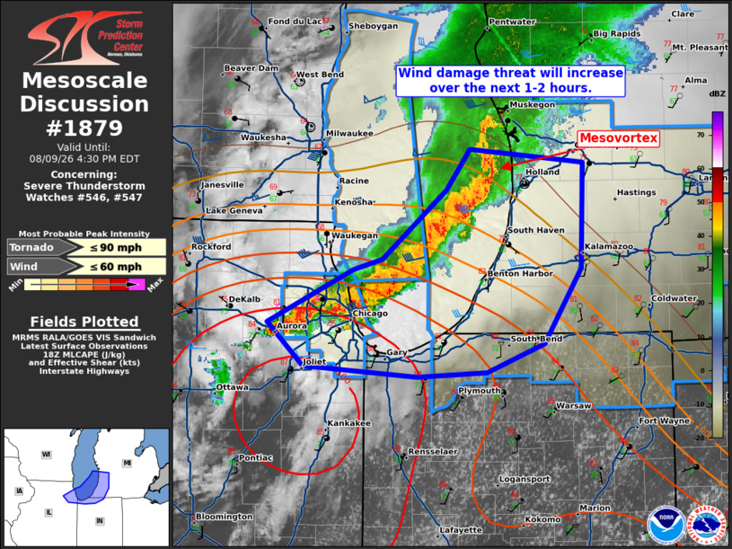
Mesoscale Discussion 1879 NWS Storm Prediction Center Norman OK 0157 PM CDT Sun Aug 09 2026 Areas affected...Southwestern Lower Michigan into far northern Indiana Concerning...Severe Thunderstorm Watch 546...547... Valid 091857Z - 092030Z The severe weather threat for Severe Thunderstorm Watch 546, 547 continues. SUMMARY...Wind damage potential will increase along the southern/eastern Lake Michigan shore over the next 1-2 hours. DISCUSSION...A linear segment is nearing the eastern Lake Michigan shoreline. The most prominent feature within this line is a small mesovortex west of Ottawa County Michigan. While this feature may locally enhance wind damage potential, the airmass ahead of it has struggled to destabilize this afternoon owing to cloud cover. Temperatures far southwest Lower Michigan and northern Indiana are warmer. These locations should have a locally greater wind damage threat given the steeper low-level lapse rates and larger overall buoyancy. Further extensions in area/time of WW 546 may be needed into northwest Indiana given current convective trends. ..Wendt.. 08/09/2026 ...Please see www.spc.noaa.gov for graphic product... ATTN...WFO...IWX...GRR...LOT... LAT...LON 41468706 41548807 41838839 42188763 42248736 42708680 42978659 42888558 42198559 41698592 41498643 41468706 MOST PROBABLE PEAK TORNADO INTENSITY...UP TO 90 MPH MOST PROBABLE PEAK WIND GUST...UP TO 60 MPH |
|
|
Top/All Mesoscale Discussions/Forecast Products/Home |
|
Source link