

| Mesoscale Discussion 1878 | |
| < Previous MD | |
|
|
   Mesoscale Discussion 1878
   NWS Storm Prediction Center Norman OK
   1124 AM CDT Sun Aug 09 2026

   Areas affected...Southwestern Lower Michigan into far northern
   Indiana

   Concerning...Severe potential...Watch possible

   Valid 091624Z - 091800Z

   Probability of Watch Issuance...60 percent

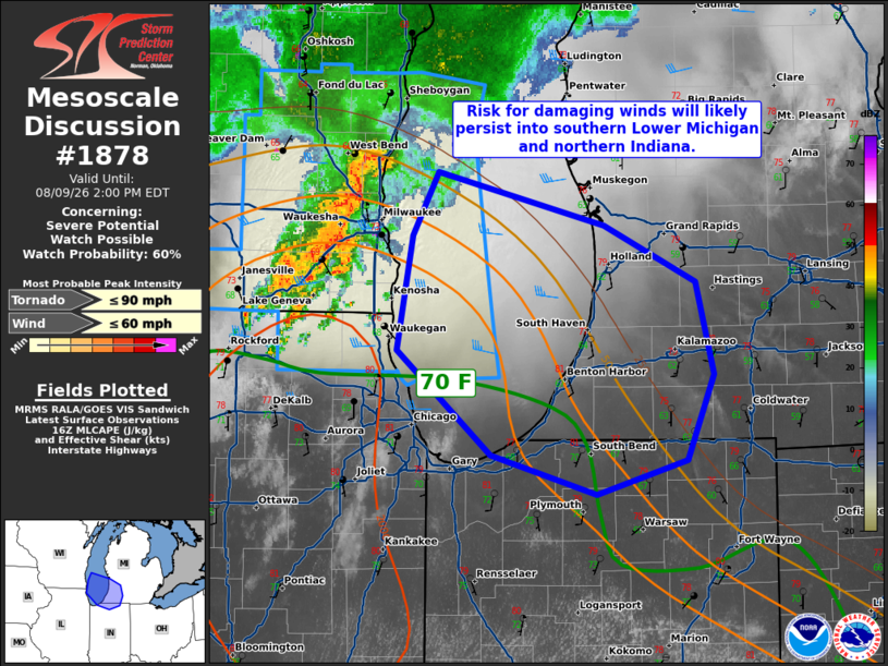
   SUMMARY...Risk for damaging winds will increase in northern Indiana
   and southern Lower Michigan as a bowing segment moves
   south-southeast into the afternoon. A watch is possible for portions
   of these areas.

   DISCUSSION...Dewpoints continue to increase ahead of a small bowing
   cluster currently near Milwaukee. By the time this cluster crosses
   southern Lake Michigan, temperatures in southeastern Lower
   Michigan/far northern Indiana will be in the 80s F. Sufficient shear
   and modest lift from a convectively enhanced perturbation should
   allow this activity to move along the lifting theta-e gradient. Some
   risk for damaging winds will likely accompany this bowing segment
   into the afternoon. A watch is possible for portions of Lower
   Michigan and northern Indiana.

   ..Wendt/Hart.. 08/09/2026

   ...Please see www.spc.noaa.gov for graphic product...

   ATTN...WFO...IWX...GRR...LOT...

   LAT...LON   42278777 42948765 43318744 43008613 42678541 42138528
               41648549 41448619 41678702 42278777

   MOST PROBABLE PEAK TORNADO INTENSITY...UP TO 90 MPH
   MOST PROBABLE PEAK WIND GUST...UP TO 60 MPH
|
|
|
Top/All Mesoscale Discussions/Forecast Products/Home |
|
Source link