

| Mesoscale Discussion 1870 | |
| < Previous MD | |

|
|
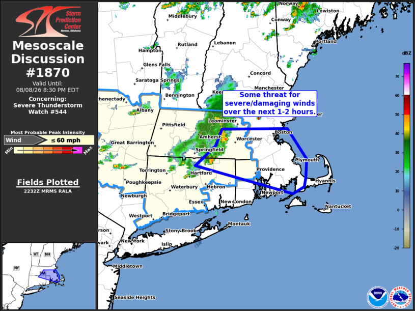
Mesoscale Discussion 1870 NWS Storm Prediction Center Norman OK 0534 PM CDT Sat Aug 08 2026 Areas affected...Northeast Connecticut...northern Rhode Island...and eastern Massachusetts Concerning...Severe Thunderstorm Watch 544... Valid 082234Z - 090030Z The severe weather threat for Severe Thunderstorm Watch 544 continues. SUMMARY...Some threat for damaging/severe winds will likely persist into portions of eastern Massachusetts over the next 1-2 hours. A local expansion of WW 544 has been made to address this potential. DISCUSSION...A band of convection with a history of wind damage continues to move east across the New England region. Although the band has taken on a somewhat more pronounced bowing structure, latest radar imagery from KBOX shows the emergence of an outflow boundary on the southern flank of the line. This hints at some degree of weakening. However, surface observations downstream continue to show a warm and moist air mass in place that is supporting a pocket of MLCAPE between 1500-2000 J/kg. Additionally, the KBOX VWP is sampling 30-50 knot flow between 5-7 km AGL, which is yielding stronger deep-layer bulk shear than depicted by recent mesoanalyses. Consequently, is seems probable that this line will maintain some degree of intensity (especially on the northern flank) as it moves into eastern MA over the next 1-2 hours with some threat for damaging/severe winds (most likely peak gusts in the 45-60 mph range based on recent observations and the downstream environment). ..Moore.. 08/08/2026 ...Please see www.spc.noaa.gov for graphic product... ATTN...WFO...BOX... LAT...LON 41927257 42207218 42447206 42457079 42017041 41747044 41617046 41527069 41927257 MOST PROBABLE PEAK WIND GUST...UP TO 60 MPH |
|
|
Top/All Mesoscale Discussions/Forecast Products/Home |
|
Source link