

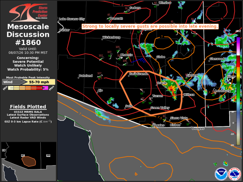
| Mesoscale Discussion 1860 | |
| < Previous MD | |

|
|
   Mesoscale Discussion 1860
   NWS Storm Prediction Center Norman OK
   1035 PM CDT Fri Aug 07 2026

   Areas affected...Parts of southeast AZ

   Concerning...Severe potential...Watch unlikely

   Valid 080335Z - 080530Z

   Probability of Watch Issuance...5 percent

   SUMMARY...Strong to locally severe gusts are possible into late
   evening.

   DISCUSSION...Some increase in storm coverage and intensity has been
   noted within the last hour to the northeast of Tucson, with cooling
   cloud tops noted on IR imagery. This uptick has occurred as
   southwesterly moving outflow interacts with local terrain features
   and moderate buoyancy. With increasing CINH downstream of this
   convection, the magnitude and longevity of any severe threat remains
   uncertain. However, weak northeasterly steering flow will allow
   outflow to continue spreading southwestward. In the presence of a
   remnant well-mixed boundary layer and steep low-level lapse rates,
   potential for strong to locally severe gusts may continue into the
   late evening, even if deep convection begins to weaken with time.

   ..Dean/Mosier.. 08/08/2026

   ...Please see www.spc.noaa.gov for graphic product...

   ATTN...WFO...TWC...PSR...

   LAT...LON   31821020 31701096 31961163 32721206 33001179 33011101
               32711007 32400987 32110987 31890993 31821020

   MOST PROBABLE PEAK WIND GUST...55-70 MPH
|
|
|
Top/All Mesoscale Discussions/Forecast Products/Home |
|
Source link