

| Mesoscale Discussion 1859 | |
| < Previous MD | |

|
|
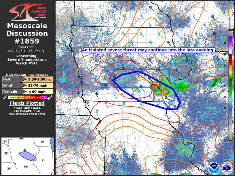
Mesoscale Discussion 1859 NWS Storm Prediction Center Norman OK 0848 PM CDT Fri Aug 07 2026 Areas affected...South-central/southeast IA into adjacent parts of northeast MO and northwest IL Concerning...Severe Thunderstorm Watch 541... Valid 080148Z - 080315Z The severe weather threat for Severe Thunderstorm Watch 541 continues. SUMMARY...An isolated severe threat may continue into the late evening. DISCUSSION...An isolated but persistent supercell is moving across southeast IA this evening, within an environment characterized by strong buoyancy (MLCAPE of 2000-3000 J/kg) and sufficient deep-layer shear for storm organization. Increasing CINH should eventually lead to a weakening trend with this cell, but some threat for hail and damaging wind may persist as the storm continues to propagate along convective outflow and approaches the southeast edge of WW 541. Additional storms have developed to the northwest of the ongoing supercell. While these storms are likely somewhat elevated, steep midlevel lapse rates (as observed in the 00Z OAX and DVN soundings) will support potential for isolated hail with the strongest cells. Farther west, isolated development cannot be ruled out along the trailing cold front into south-central IA, but large-scale ascent is generally weak, and the window of opportunity is decreasing with onset of nocturnal cooling and increasing CINH. The environment remains conditionally favorable in this area, if any storms can develop through late evening. ..Dean.. 08/08/2026 ...Please see www.spc.noaa.gov for graphic product... ATTN...WFO...DVN...DMX...EAX... LAT...LON 41629250 41089116 40559080 40279097 40299152 40629291 41059384 41429428 41639383 41779295 41629250 MOST PROBABLE PEAK TORNADO INTENSITY...UP TO 90 MPH MOST PROBABLE PEAK WIND GUST...55-70 MPH MOST PROBABLE PEAK HAIL SIZE...1.50-2.50 IN |
|
|
Top/All Mesoscale Discussions/Forecast Products/Home |
|
Source link