

| Mesoscale Discussion 1845 | |
| < Previous MD | |

|
|
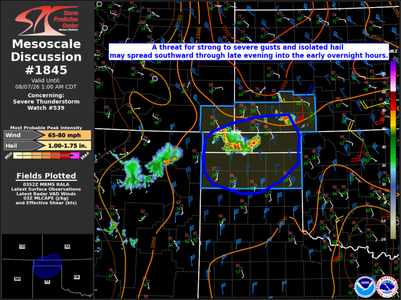
Mesoscale Discussion 1845 NWS Storm Prediction Center Norman OK 1055 PM CDT Thu Aug 06 2026 Areas affected...Parts of the OK/TX Panhandles into extreme southwest KS/southeast CO Concerning...Severe Thunderstorm Watch 539... Valid 070355Z - 070600Z The severe weather threat for Severe Thunderstorm Watch 539 continues. SUMMARY...A threat for strong to severe gusts and isolated hail may spread southward through late evening into the early overnight hours. DISCUSSION...An isolated supercell is moving slowly southward across far southwest KS late this evening. The 00Z DDC sounding depicted a favorable environment, with greater than 2500 J/kg of MLCAPE and sufficient northwesterly flow aloft for 40+ kt of effective shear. With a continued nocturnal increase in MLCINH expected, the longevity of this cell may be limited. However, there have been some indications of backbuilding along the trailing outflow, and a threat for strong to severe gusts and isolated hail could spread toward the eastern OK Panhandle, if a small cluster can evolve with time. Farther west, some modest clustering has been noted from extreme southeast CO. These ongoing storms may struggle to become better organized due to increasing CINH, but northerly mid/upper-level flow a modest nocturnal low-level jet may help to sustain a southward moving cluster into the northern TX Panhandle with time tonight. Despite increasing near-surface stability, a remnant well-mixed boundary layer will support potential for strong to severe gusts, especially if more robust outflow can become established. ..Dean.. 08/07/2026 ...Please see www.spc.noaa.gov for graphic product... ATTN...WFO...DDC...AMA...PUB... LAT...LON 36780292 36990275 37210215 37380126 37430038 36940005 36210011 35790063 35530122 35480180 35720269 36020293 36330296 36780292 MOST PROBABLE PEAK WIND GUST...65-80 MPH MOST PROBABLE PEAK HAIL SIZE...1.00-1.75 IN |
|
|
Top/All Mesoscale Discussions/Forecast Products/Home |
|
Source link