

With the climatological peak of hurricane season approaching in early September, NOAA’s prediction for below-normal activity in the Atlantic basin remains.
Forecasters from NOAA’s National Weather Service updated today the number of expected named storms to 7-13 (with winds of 39 mph or greater), of which 2-6 could become hurricanes (winds of 74 mph or greater), including 0-2 major hurricanes (winds of 111 mph or greater). These ranges cover the entire season from June 1 through November 30 and are inclusive of the two tropical storms that have already formed.
NOAA forecasters predict a 75% chance for below-normal activity, with a 20% chance of a near-normal season, and just a 5% chance of above-normal activity. This updated prediction is similar to the initial outlook issued in May.
In the Atlantic basin, a typical hurricane season will yield 14 named storms, of which seven become hurricanes, including three major hurricanes.
Only Gulf storms in the Atlantic Basin so far
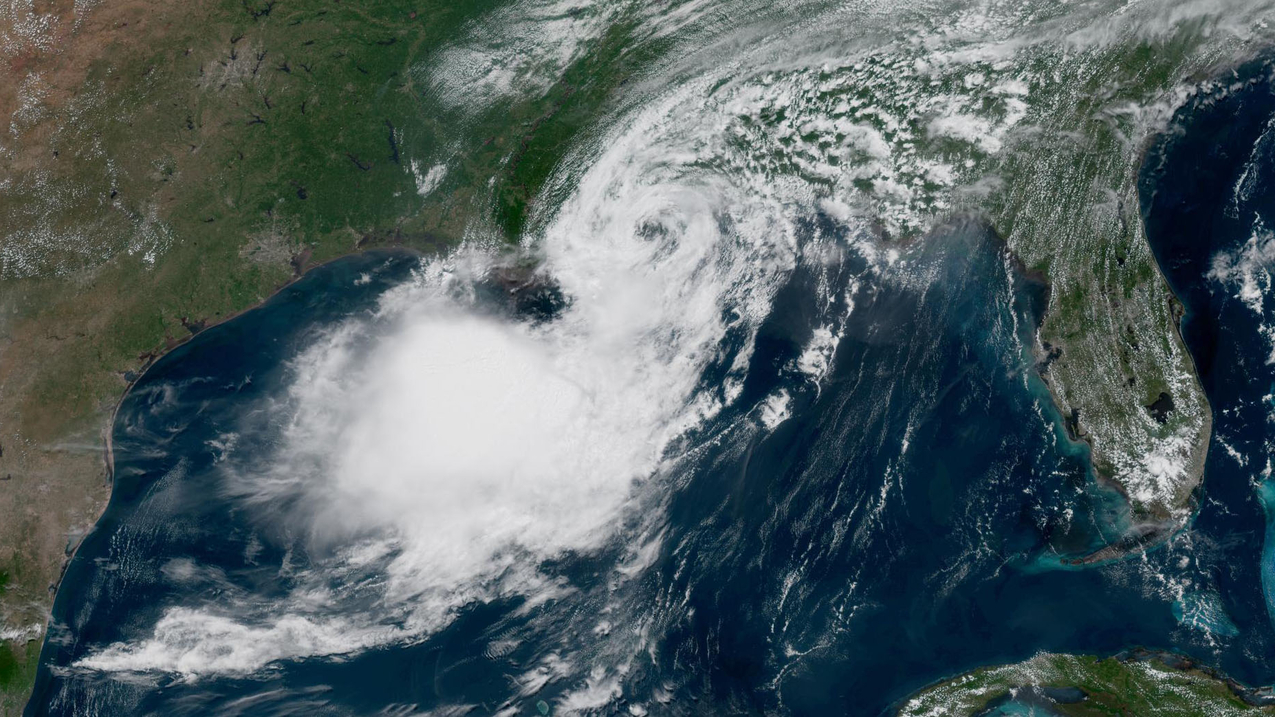
To date, the 2026 season has produced two named tropical storms, Arthur and Bertha, and no hurricanes. Tropical Storm Arthur was the first named storm of the Atlantic season. Forming in mid-June in the warm Gulf of America waters off the Texas coast, Arthur brought record rainfall to portions of Louisiana and spawned tornadoes along the Gulf coast. Bertha also formed in the Gulf, originating south of the Florida panhandle before making landfall in St. Bernard Parish, Louisiana.
“Inland rainfall is a major cause of damage from tropical storms and hurricanes, as Arthur demonstrated,” said NOAA’s National Weather Service Director Ken Graham. “That’s why it’s important to prepare for every storm that’s projected to impact your area, even if it never reaches hurricane strength.”
Factors influencing the Atlantic hurricane season outlook
For the remainder of the season, tropical storm activity in the Atlantic basin is expected to be tempered by El Nino conditions, which first emerged in the equatorial Pacific in June. El Nino increases wind shear, which tends to prevent tropical storms from forming or from getting stronger once formed. Other less influential factors include temperatures near average in the Atlantic Ocean and a neutral west African monsoon.
“When El Nino emerges, it usually becomes the dominant factor in total hurricane season activity, and this El Nino continues to get stronger every month,” said Matt Rosencrans, lead hurricane season forecaster with NOAA’s National Weather Service.“Compared to a mature El Nino, other mechanisms play a smaller role in determining the number and intensity of tropical storms in the Atlantic basin.”
Hurricane outlooks in other ocean basins
Although El Nino tends to limit tropical activity in the Atlantic, it can enhance storm development in the Pacific. NOAA’s outlook for the Eastern Pacific hurricane season remains unchanged with 15-22 named storms, which is above average. So far there have been seven named storms, of which two became hurricanes, including one major hurricane. An above-normal season is also expected in the Central Pacific basin, with 5-13 named storms and tropical depressions.
About NOAA’s Hurricane Season Outlook
NOAA’s Hurricane Season Outlook is for overall seasonal activity and is not a landfall forecast. Landfalls are largely determined by short-term weather patterns, which are only predictable within about a week of a storm potentially reaching land. NOAA’s National Hurricane Center (NHC) provides tropical weather outlooks out to seven days in advance, provides track and intensity forecasts for individual storms and issues watches and warnings for specific tropical storms, hurricanes and the associated storm surge.
Stay informed
Consult the NHC website, hurricanes.gov, for the latest about tropical storm and hurricane activity in the Atlantic and Pacific Ocean basins. You can also follow regular updates from NHC on X at @NHC_Atlantic offsite link and on Facebook. You can also access additional tips and resources to stay safe this season.
Source link