

| Mesoscale Discussion 1831 | |
| < Previous MD | |

|
|
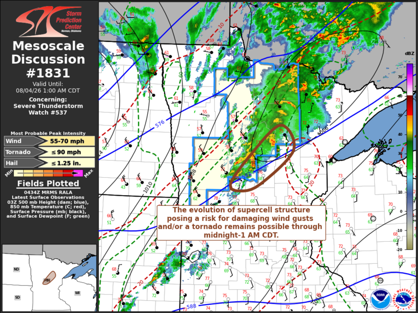
Mesoscale Discussion 1831 NWS Storm Prediction Center Norman OK 1136 PM CDT Mon Aug 03 2026 Areas affected...parts of north central Minnesota Concerning...Severe Thunderstorm Watch 537... Valid 040436Z - 040600Z The severe weather threat for Severe Thunderstorm Watch 537 continues. SUMMARY...Isolated strong to severe thunderstorm development posing a risk for damaging wind gusts and/or a tornado still appears possible near and north-northeast of the Brainerd MN vicinity through around 1 AM CDT. Otherwise, the risk for severe weather has diminished enough that a new severe weather watch is not anticipated. DISCUSSION...Post-frontal 2-hourly surface pressure rises continue to strengthen, with the cold front now advancing across/east of the Park Rapids and Alexandria vicinities. The primary developing surface frontal low now appears north of the international border, but at least a transient 2-hourly fall center (2.5 mb) was recorded in the 04Z surface observation at Brainerd, where the pre-frontal boundary-layer still appears characterized by modest CAPE (aided by upper 60s F surface dew points), in the presence of strong shear. Given this environment, the potential for an additional evolving supercell structure still appears possible just ahead of, or along, the cold front near and north-northeast of the Brainerd vicinity, before the cold front overtakes this region by around 06Z. ..Kerr.. 08/04/2026 ...Please see www.spc.noaa.gov for graphic product... ATTN...WFO...DLH...MPX...FGF... LAT...LON 46759457 47409363 46909324 46229421 46099478 46219509 46759457 MOST PROBABLE PEAK TORNADO INTENSITY...UP TO 90 MPH MOST PROBABLE PEAK WIND GUST...55-70 MPH MOST PROBABLE PEAK HAIL SIZE...UP TO 1.25 IN |
|
|
Top/All Mesoscale Discussions/Forecast Products/Home |
|
Source link