

| Mesoscale Discussion 1822 | |
| < Previous MD | |

|
|
   Mesoscale Discussion 1822
   NWS Storm Prediction Center Norman OK
   1209 PM CDT Sun Aug 02 2026

   Areas affected...portions of the Central Appalachians

   Concerning...Severe potential...Watch unlikely

   Valid 021709Z - 021915Z

   Probability of Watch Issuance...20 percent

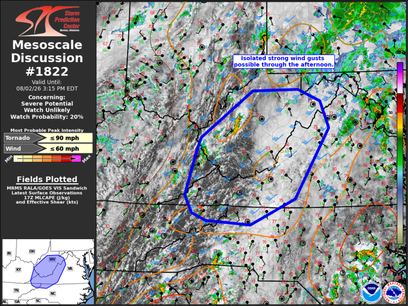
   SUMMARY...Sporadic strong wind gusts are possible through the
   afternoon. Overall severe potential is expected to remain limited
   and a watch is not currently anticipated.

   DISCUSSION...Thunderstorms are gradually increasing in coverage and
   intensity early this afternoon across the higher terrain of West
   Virginia. Additional convection is expected to develop with
   southward extent as modest destabilization continues into the
   afternoon. Rich boundary layer moisture with dewpoints in the upper
   60s to mid 70s is fostering up to 1000 J/kg MLCAPE, though lapse
   rates are expected to remain modest today. Stronger vertical shear
   in proximity to the upper trough and surface low, with effective
   shear magnitudes in the 25-35 kt range, will support occasional
   organized clusters capable of producing locally strong wind gusts.
   Backed low-level flow, with vertically veering wind profiles, will
   support modest 0-1 km SRH (around 100 m2/s2 per latest SPC
   Mesoanalysis). This could support modest storm rotation, and a brief
   tornado also is possible, though this risk will be muted by poor
   low-level lapse rates and overall weak thermodynamic profiles. The
   overall severe risk is expected to remain limited/transient across
   the broader region, and a watch is not currently expected.

   ..Leitman/Mosier.. 08/02/2026

   ...Please see www.spc.noaa.gov for graphic product...

   ATTN...WFO...LWX...RNK...PBZ...RLX...GSP...MRX...JKL...

   LAT...LON   38198248 39308095 39337957 39067892 38427866 36757970
               36148102 36238233 36428275 36838294 37918261 38198248

   MOST PROBABLE PEAK TORNADO INTENSITY...UP TO 90 MPH
   MOST PROBABLE PEAK WIND GUST...UP TO 60 MPH
|
|
|
Top/All Mesoscale Discussions/Forecast Products/Home |
|
Source link