

| Mesoscale Discussion 1797 | |
| < Previous MD Next MD > | |

|
|
   Mesoscale Discussion 1797
   NWS Storm Prediction Center Norman OK
   0252 PM CDT Wed Jul 29 2026

   Areas affected...eastern Montana...northeastern Wyoming...western
   Dakotas

   Concerning...Severe potential...Watch possible

   Valid 291952Z - 292145Z

   Probability of Watch Issuance...60 percent

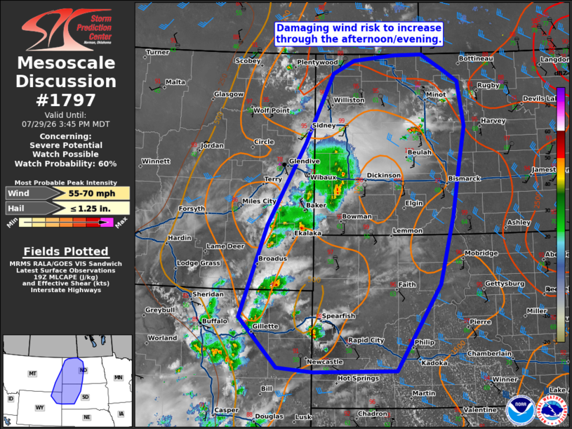
   SUMMARY...Thunderstorms will increase in coverage and spread
   eastward through the afternoon/evening. One more more clusters of
   damaging wind will be possible.

   DISCUSSION...Thunderstorm activity is increasing in coverage across
   the high terrain in eastern MT/WY. A cluster of thunderstorms also
   continues eastward across eastern North Dakota, producing gusts up
   to 57 mph. Downstream across the western Dakotas, temperatures have
   warmed into the upper 90s to 100s F with dew points in the upper 50s
   to 60s F amid strong MLCIN and sunny skies through most of the day.
   18z soundings from BIS and UNR show moderate instability amid dry
   sub-cloud layers near the surface. Also sampled are steep low to
   mid-level lapse rates around 7-8 C/km. SPC Mesoanalysis would
   suggest that MLCIN is eroding. This environment will support
   potential for strong to severe gusts. Guidance suggests that one or
   more organized clusters may develop and spread eastward through the
   afternoon. A watch may be needed to cover this potential this
   afternoon.

   ..Thornton/Hart.. 07/29/2026

   ...Please see www.spc.noaa.gov for graphic product...

   ATTN...WFO...ABR...BIS...UNR...BYZ...GGW...

   LAT...LON   44520581 46090516 47490425 48660358 48880306 48980206
               48980137 48730084 48520047 47770033 47180045 46250063
               45100096 43620202 43600403 43680490 44520581

   MOST PROBABLE PEAK WIND GUST...55-70 MPH
   MOST PROBABLE PEAK HAIL SIZE...UP TO 1.25 IN
|
|
|
Top/All Mesoscale Discussions/Forecast Products/Home |
|
Source link