

| Mesoscale Discussion 1795 | |
| < Previous MD | |

|
|
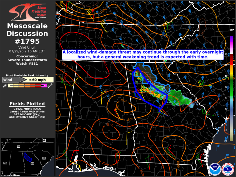
Mesoscale Discussion 1795 NWS Storm Prediction Center Norman OK 1145 PM CDT Tue Jul 28 2026 Areas affected...Parts of north GA Concerning...Severe Thunderstorm Watch 531... Valid 290445Z - 290615Z The severe weather threat for Severe Thunderstorm Watch 531 continues. SUMMARY...A localized wind-damage threat may continue through the early overnight hours, though a general weakening trend is expected with time. DISCUSSION...An outflow-driven storm cluster is propagating southward across north GA as of 0445 UTC. Moist low-level west-northwesterly flow impinging upon the gust front will help to sustain convection through the early overnight hours, though increasing MLCINH with time and southward extent should eventually result in a weakening trend. Observed gusts have generally been sub-severe thus far, though downbursts associated with the strongest embedded cores may remain capable of producing localized wind damage, until a more definitive weakening trend occurs. ..Dean.. 07/29/2026 ...Please see www.spc.noaa.gov for graphic product... ATTN...WFO...FFC... LAT...LON 34788492 34138439 33768380 33568339 33288346 32998376 33348461 33728498 34248516 34528519 34788492 MOST PROBABLE PEAK WIND GUST...UP TO 60 MPH |
|
|
Top/All Mesoscale Discussions/Forecast Products/Home |
|
Source link