

| Mesoscale Discussion 1762 | |
| < Previous MD | |

|
|
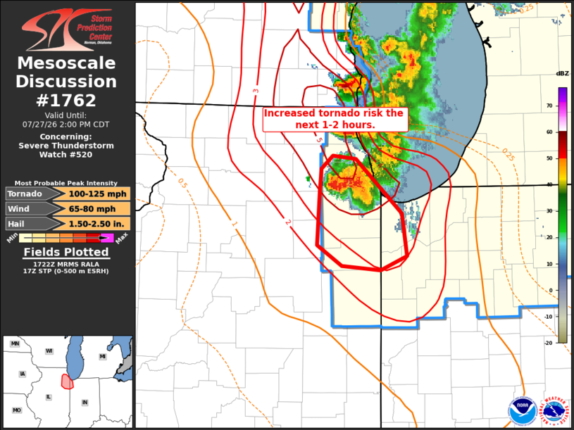
Mesoscale Discussion 1762 NWS Storm Prediction Center Norman OK 1224 PM CDT Mon Jul 27 2026 Areas affected...northeast IL/northwest IN Concerning...Severe Thunderstorm Watch 520... Valid 271724Z - 271900Z The severe weather threat for Severe Thunderstorm Watch 520 continues. SUMMARY...A favorable environment supporting large to very large hail and a tornado risk will develop across portions of northeast IL into northwest IN over the next 1-2 hours. DISCUSSION...A supercell located over northeast IL will develop south/southeast across the southern greater Chicago metro vicinity. The downstream airmass is very moist (mid/upper 70s dewpoints) and unstable (3000-4000 J/kg MLCAPE). Favorable vertical shear with 50+ kt effective shear magnitudes and 0-1 SRH near 125 m2/s2 is noted from the KLOT VWP. Effective STP values have increased to 3-5 as well. This environment will continue to support supercell structures with a continued risk for very large hail to around 2.5 inches, strong wind gusts, and possibly a strong tornado over the next 1-2 hours. ..Leitman.. 07/27/2026 ...Please see www.spc.noaa.gov for graphic product... ATTN...WFO...LOT... LAT...LON 42018782 41528726 41138721 40998753 41038799 41228829 41718827 41928825 42058811 42018782 MOST PROBABLE PEAK TORNADO INTENSITY...100-125 MPH MOST PROBABLE PEAK WIND GUST...65-80 MPH MOST PROBABLE PEAK HAIL SIZE...1.50-2.50 IN |
|
|
Top/All Mesoscale Discussions/Forecast Products/Home |
|
Source link