

| Mesoscale Discussion 1754 | |
| < Previous MD Next MD > | |

|
|
   Mesoscale Discussion 1754
   NWS Storm Prediction Center Norman OK
   1139 PM CDT Sun Jul 26 2026

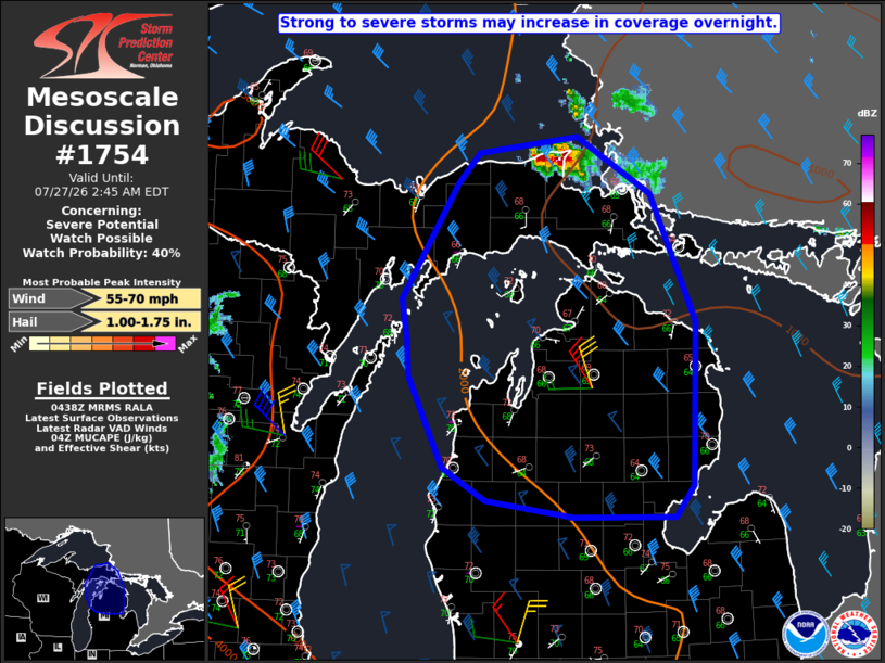
   Areas affected...Eastern Upper MI into northern Lower MI

   Concerning...Severe potential...Watch possible

   Valid 270439Z - 270645Z

   Probability of Watch Issuance...40 percent

   SUMMARY...Strong to severe storms may increase in coverage
   overnight.

   DISCUSSION...A small storm cluster has recently intensified across
   southeast Lake Superior and adjacent Upper MI. This convection is
   potentially being aided by a low-amplitude midlevel shortwave trough
   moving southeastward across the region. There may be some tendency
   for storms to increase in coverage overnight and move
   south-southeastward along the primary buoyancy gradient. Relatively
   steep midlevel lapse rates, moderate buoyancy, and effective shear
   of 40+ kt will continue to conditionally support storm organization.
   Isolated hail may occur with the strongest cells, while any notable
   upscale growth could result in an increasing wind-damage threat.

   Uncertainty remains high regarding storm evolution overnight, and
   short-term guidance continues to struggle with handling ongoing
   convection. While the severe threat may remain relatively isolated
   in this region, watch issuance is possible if observational trends
   support an increasing coverage of severe threat.

   ..Dean/Smith.. 07/27/2026

   ...Please see www.spc.noaa.gov for graphic product...

   ATTN...WFO...DTX...APX...GRR...MQT...

   LAT...LON   46758598 46888488 46428405 45428356 44138360 43878380
               43878492 44008589 44268637 44988676 45278678 45608683
               46518621 46758598

   MOST PROBABLE PEAK WIND GUST...55-70 MPH
   MOST PROBABLE PEAK HAIL SIZE...1.00-1.75 IN
|
|
|
Top/All Mesoscale Discussions/Forecast Products/Home |
|
Source link