

| Mesoscale Discussion 1752 | |
| < Previous MD | |

|
|
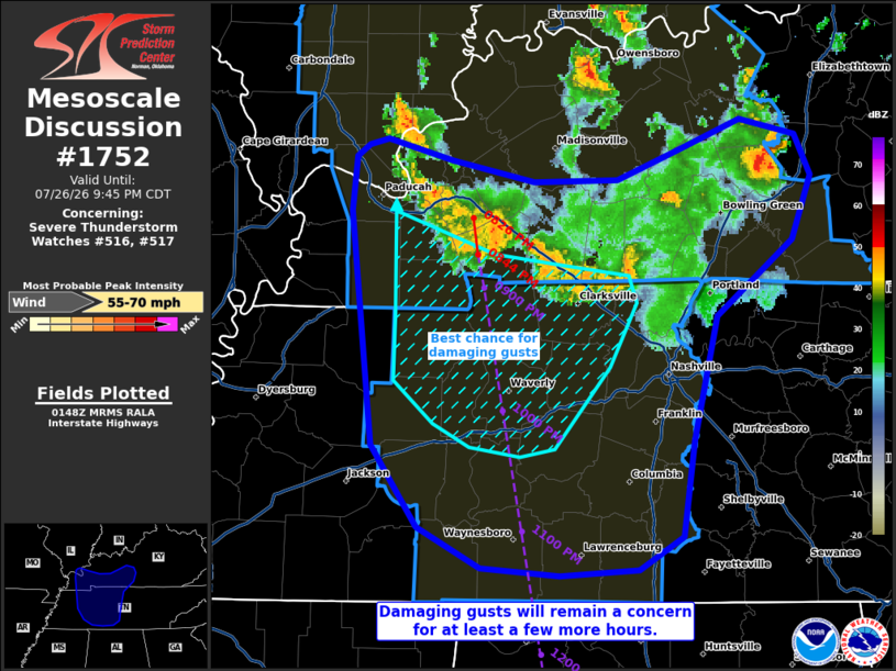
Mesoscale Discussion 1752 NWS Storm Prediction Center Norman OK 0851 PM CDT Sun Jul 26 2026 Areas affected...portions of far southern Kentucky into western and middle Tennessee Concerning...Severe Thunderstorm Watch 516...517... Valid 270151Z - 270245Z The severe weather threat for Severe Thunderstorm Watch 516, 517 continues. SUMMARY...Damaging gusts remain a concern for the next few hours, a couple of which may reach 55-70 mph. DISCUSSION...A cold-pool-driven MCS continues to propagate southward across southern KY and is approaching western and middle TN. This MCS has a history of damaging gusts, and continues to traverse a corridor of 4000-5000 J/kg MLCAPE and 30-40 kts of effective bulk shear. While this MCS is beginning to outpace the more favorable vertical wind shear, the rich moisture in place (e.g. the 75-80 F dewpoints contributing to the extreme buoyancy) will compensate for a continued damaging gust threat for at least a few more hours. Since the MCS continues to track southward at approximately 30-35 kts, it is poised to cross western and middle TN in the 9-11 PM CDT period. ..Squitieri.. 07/27/2026 ...Please see www.spc.noaa.gov for graphic product... ATTN...WFO...LMK...OHX...HUN...PAH...MEG... LAT...LON 35808865 37008878 37278876 37348868 37378856 37268815 37148763 37158710 37318671 37468632 37388597 37178587 36858599 36468647 35828661 35338669 35168697 35138747 35178796 35378837 35808865 MOST PROBABLE PEAK WIND GUST...55-70 MPH |
|
|
Top/All Mesoscale Discussions/Forecast Products/Home |
|
Source link