

| Mesoscale Discussion 1745 | |
| < Previous MD | |

|
|
   Mesoscale Discussion 1745
   NWS Storm Prediction Center Norman OK
   0354 PM CDT Sun Jul 26 2026

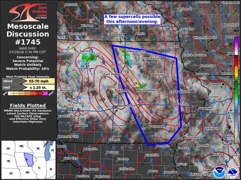
   Areas affected...eastern Iowa

   Concerning...Severe potential...Watch unlikely

   Valid 262054Z - 262230Z

   Probability of Watch Issuance...20 percent

   SUMMARY...A few supercells are possible this afternoon/evening.

   DISCUSSION...A few weak cells have been moving slowly eastward
   across northern Iowa this morning in vicinity of the a weak MCV
   moving across the area. Within the last 20 minutes, convective
   intensity has started to increase somewhat. Given the weak forcing,
   it is is not clear whether these storms will mature, but if they do,
   4000-5000 J/kg MLCAPE and 45 to 50 knots of effective shear will
   support supercells capable of large hail and severe wind gusts.

   ..Bentley/Leitman.. 07/26/2026

   ...Please see www.spc.noaa.gov for graphic product...

   ATTN...WFO...DVN...ARX...DMX...EAX...

   LAT...LON   42459354 43379386 43259268 43019136 41079120 40599170
               40549245 41579309 42459354

   MOST PROBABLE PEAK WIND GUST...55-70 MPH
   MOST PROBABLE PEAK HAIL SIZE...UP TO 1.25 IN
|
|
|
Top/All Mesoscale Discussions/Forecast Products/Home |
|
Source link