

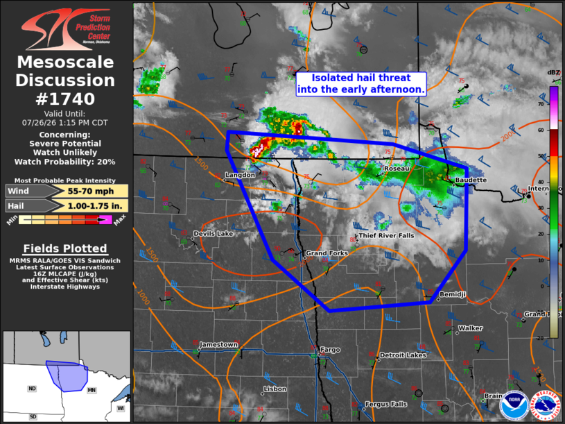
| Mesoscale Discussion 1740 | |
| < Previous MD | |

|
|
   Mesoscale Discussion 1740
   NWS Storm Prediction Center Norman OK
   1139 AM CDT Sun Jul 26 2026

   Areas affected...far northeast North Dakota and northwest Minnesota

   Concerning...Severe potential...Watch unlikely

   Valid 261639Z - 261815Z

   Probability of Watch Issuance...20 percent

   SUMMARY...An isolated hail threat will exist through early afternoon
   across far northeast North Dakota and northwest Minnesota.

   DISCUSSION...An elevated supercell has shown some sign of
   strengthening in the last hour as it moves from Manitoba into
   northeast North Dakota. This supercell is elevated, within the post
   outflow boundary airmass at this time. Already weak forcing, from
   weak isentropic ascent, is expected to weaken further into the early
   afternoon as low-level flow dissipates. This casts some uncertainty
   as to the fate of this activity. However, the downstream airmass is
   destabilizing and temperatures near 90 with dewpoints in the 70s may
   be sufficient for surface-based storm development.

   Given this uncertainty and isolated storm coverage, a watch is not
   anticipated. However, if there are signs of surface-based transition
   and/or additional storm development within the next 1 to 2 hours, a
   watch may need to be considered.

   ..Bentley/Leitman.. 07/26/2026

   ...Please see www.spc.noaa.gov for graphic product...

   ATTN...WFO...DLH...FGF...

   LAT...LON   49279830 49169559 48899438 48009442 47449501 47349663
               47899755 49089833 49279830

   MOST PROBABLE PEAK WIND GUST...55-70 MPH
   MOST PROBABLE PEAK HAIL SIZE...1.00-1.75 IN
|
|
|
Top/All Mesoscale Discussions/Forecast Products/Home |
|
Source link