

| Mesoscale Discussion 1737 | |
| < Previous MD Next MD > | |

|
|
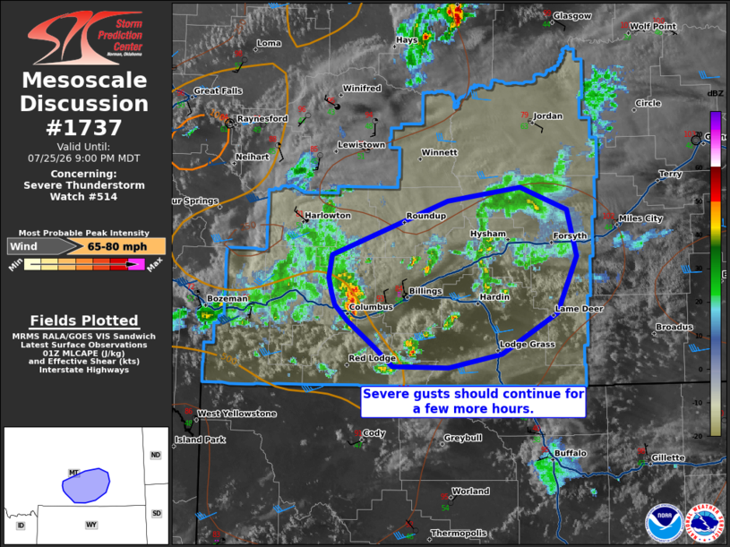
Mesoscale Discussion 1737 NWS Storm Prediction Center Norman OK 0834 PM CDT Sat Jul 25 2026 Areas affected...portions of southern Montana Concerning...Severe Thunderstorm Watch 514... Valid 260134Z - 260300Z The severe weather threat for Severe Thunderstorm Watch 514 continues. SUMMARY...A few severe gusts remain possible through the evening hours. DISCUSSION...Thunderstorms have shown a slight decreasing trend in overall coverage and intensity over the past hour. Nonetheless, a few intense convective cells remain in progress, particularly over Stillwater County, MT. Surface temperatures range from 90-100 F ahead of the ongoing storms, suggesting that a well-mixed boundary layer remains in place to support a few more potentially severe gusts with the stronger storm cores. However, the severe threat should gradually subside in a few hours with the onset of nocturnal cooling. ..Squitieri.. 07/26/2026 ...Please see www.spc.noaa.gov for graphic product... ATTN...WFO...BYZ... LAT...LON 45150798 45160868 45340891 45570925 45700940 45810945 45950948 46140945 46620798 46750707 46540648 46140635 45640661 45270731 45150798 MOST PROBABLE PEAK WIND GUST...65-80 MPH |
|
|
Top/All Mesoscale Discussions/Forecast Products/Home |
|
Source link