

| Mesoscale Discussion 1727 | |
| < Previous MD | |
|
|
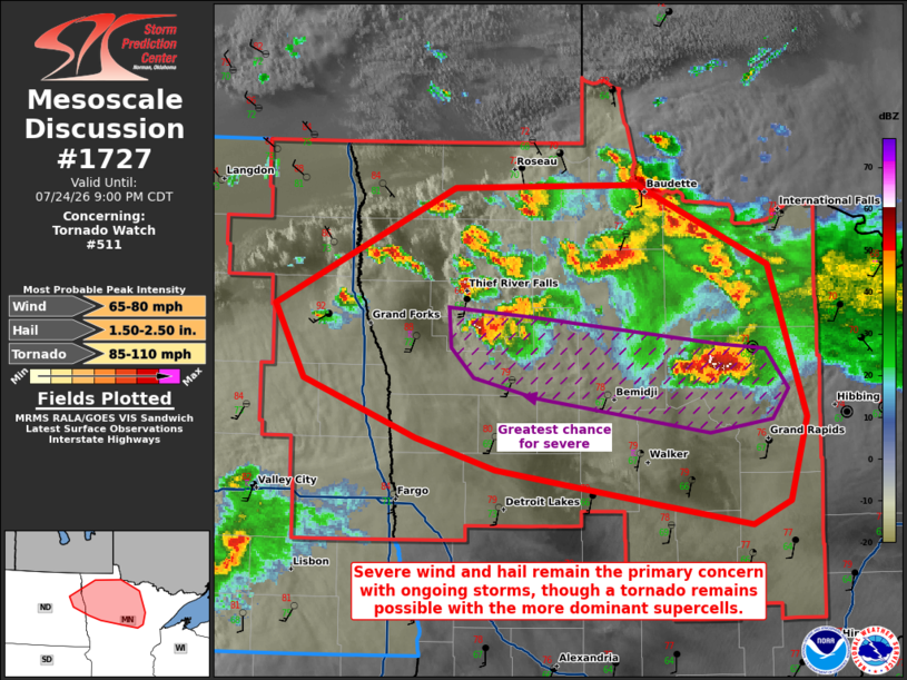
Mesoscale Discussion 1727 NWS Storm Prediction Center Norman OK 0735 PM CDT Fri Jul 24 2026 Areas affected...portions of far eastern North Dakota into northern Minnesota Concerning...Tornado Watch 511... Valid 250035Z - 250200Z The severe weather threat for Tornado Watch 511 continues. SUMMARY...Severe wind and hail will continue with ongoing supercells, with isolated tornadoes still possible. DISCUSSION...Multiple supercells continue to traverse a baroclinic zone at the terminus of a low-level warm-air advection regime, with a history of severe wind/hail and at least one brief tornado. MRMS mosaic MESH indicates severe hail is still falling with these storms, with NEXRAD velocity data showing occasional, brief bouts of low-level rotation. While an instance or two of hail may occur with multicells and transient supercells farther north of the baroclinic zone, the primary severe threat should continue with the ongoing mature supercells for at least a few hours. All severe hazards remain a concern. ..Squitieri.. 07/25/2026 ...Please see www.spc.noaa.gov for graphic product... ATTN...WFO...DLH...FGF... LAT...LON 48029786 48739628 48759465 48279350 47369318 46869333 46729365 46849447 47059591 47249661 47589761 48029786 MOST PROBABLE PEAK TORNADO INTENSITY...85-110 MPH MOST PROBABLE PEAK WIND GUST...65-80 MPH MOST PROBABLE PEAK HAIL SIZE...1.50-2.50 IN |
|
|
Top/All Mesoscale Discussions/Forecast Products/Home |
|
Source link