

| Mesoscale Discussion 1725 | |
| < Previous MD | |

|
|
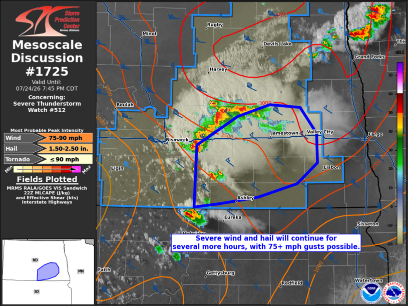
Mesoscale Discussion 1725 NWS Storm Prediction Center Norman OK 0548 PM CDT Fri Jul 24 2026 Areas affected...portions of central into southeastern North Dakota Concerning...Severe Thunderstorm Watch 512... Valid 242248Z - 250045Z The severe weather threat for Severe Thunderstorm Watch 512 continues. SUMMARY...Severe wind and hail will continue with ongoing storms for the next several hours. A wind swath is possible as storms continue to merge, and a few gusts exceeding 75 mph cannot be ruled out. DISCUSSION...Outflow from multiple high-based supercells has merged over the past hour, resulting in the development of a loosely organized cold-pool-driven MCS across central ND. This MCS is poised to propagate southeastward amid an environment comprised of steep tropospheric lapse rates and effective bulk shear well over 50 kts. Stronger cores remain embedded within this MCS, with MRMS mosaic MESH showing potentially severe hail continuing with this storm. However, multiple measured severe gusts in the 60-80 mph range have recently been received as upscale growth continues. The current thinking is that a loosely organized cluster of storms (perhaps maintaining MCS structure) will be maintained for at least a few more hours, resulting in severe wind and hail. If a more organized leading line of convection can become established, oriented normal to the northwesterly deep-layer shear vector, a severe wind swath may result. Either way, 50+ kt gusts should continue, with 75+ mph gusts also possible. ..Squitieri.. 07/24/2026 ...Please see www.spc.noaa.gov for graphic product... ATTN...WFO...FGF...BIS... LAT...LON 46790015 47179934 47339871 47309810 46959778 46559777 46269817 46089893 45999967 45950018 46790015 MOST PROBABLE PEAK TORNADO INTENSITY...UP TO 90 MPH MOST PROBABLE PEAK WIND GUST...75-90 MPH MOST PROBABLE PEAK HAIL SIZE...1.50-2.50 IN |
|
|
Top/All Mesoscale Discussions/Forecast Products/Home |
|
Source link