

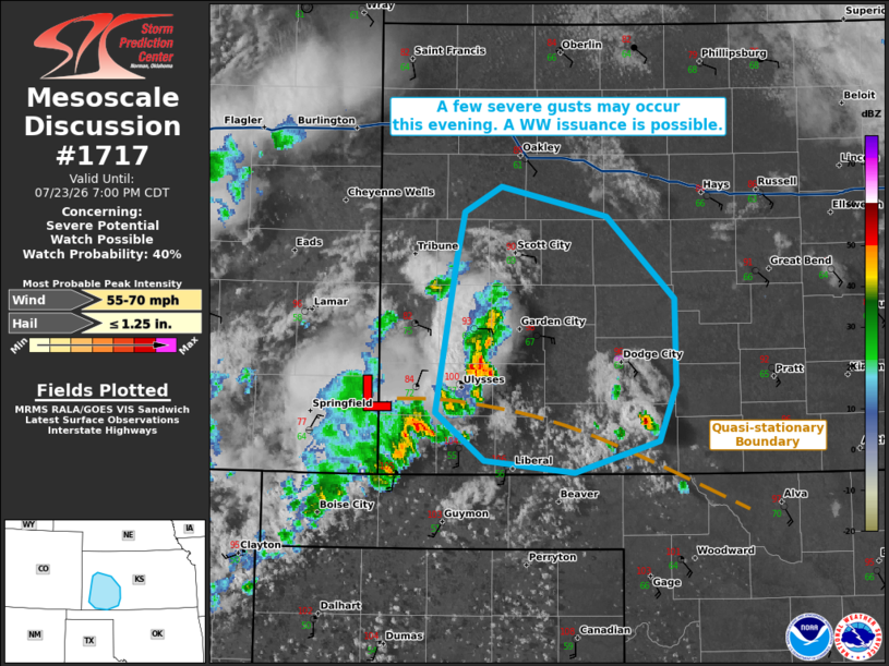
| Mesoscale Discussion 1717 | |
| < Previous MD | |

|
|
   Mesoscale Discussion 1717
   NWS Storm Prediction Center Norman OK
   0533 PM CDT Thu Jul 23 2026

   Areas affected...portions of eastern Colorado into western Kansas

   Concerning...Severe potential...Watch possible

   Valid 232233Z - 240000Z

   Probability of Watch Issuance...40 percent

   SUMMARY...A few severe gusts may occur through the evening hours
   with the stronger storms. Convective trends are being monitored for
   the need of a Severe Thunderstorm Watch issuance.

   DISCUSSION...Scattered multicells have been gradually intensifying
   ahead of a surface low along the southern CO/KS border while
   traversing a surface baroclinic boundary. Ahead of the ongoing
   storms, a well-mixed boundary layer is in place, with surface
   temperatures nearly 100 F on the north side of the front, and T/Td
   spreads in the 30-40 F range. Some of the recent DDC VAD data shows
   appreciable low-level hodograph curvature, with around 300 m2/s2
   0-3km SRH potentially contributing to continued organized
   multicellular modes merging into a loosely organized MCS through the
   evening. Should upscale growth continue, the deep and mixed boundary
   layer may encourage enough evaporative cooling with the stronger
   storms to promote a severe gust threat. An instance or two of hail
   may also occur. Either way, convective trends will continue to be
   monitored for the need of a Severe Thunderstorm Watch if storms can
   further organize and intensify on a widespread basis.

   ..Squitieri/Mosier.. 07/23/2026

   ...Please see www.spc.noaa.gov for graphic product...

   ATTN...WFO...DDC...GLD...

   LAT...LON   37400157 38410140 38740133 38910101 38720013 38169956
               37589955 37229968 37000040 37080116 37400157

   MOST PROBABLE PEAK WIND GUST...55-70 MPH
   MOST PROBABLE PEAK HAIL SIZE...UP TO 1.25 IN
|
|
|
Top/All Mesoscale Discussions/Forecast Products/Home |
|
Source link