

| Mesoscale Discussion 1694 | |
| < Previous MD Next MD > | |

|
|
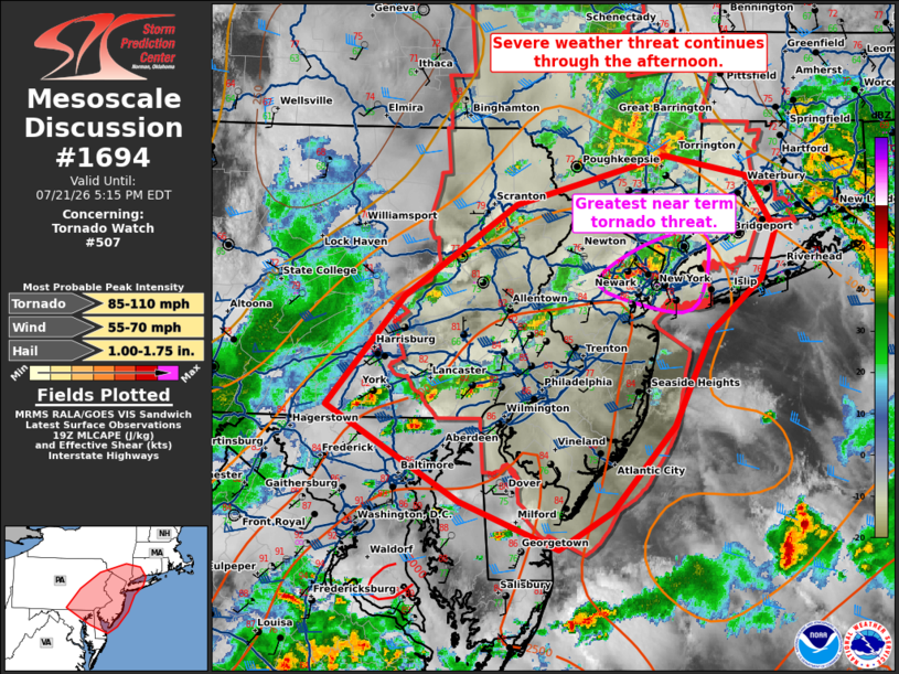
Mesoscale Discussion 1694 NWS Storm Prediction Center Norman OK 0240 PM CDT Tue Jul 21 2026 Areas affected...eastern Pennsylvania...New Jersey...southeast New York Concerning...Tornado Watch 507... Valid 211940Z - 212115Z The severe weather threat for Tornado Watch 507 continues. SUMMARY...The severe weather threat will continue through the afternoon. DISCUSSION...In the near term the greatest tornado threat will be across northeast New Jersey into southeast New York where a supercell along a warm front has continued to exhibit low-level rotation with several brief tornado reports. The downstream environment remains favorable and should maintain some damaging wind/tornado threat for the next 1 to 2 hours. Elsewhere, mid/upper level cloud cover has slowed heating and thus storm coverage has remained somewhat muted. However, the next round of storm development has begun across southeast Pennsylvania. Given continued filtered heating and increasing ascent through the day, expect additional storm development through the afternoon with a primary threat for damaging wind gusts. ..Bentley.. 07/21/2026 ...Please see www.spc.noaa.gov for graphic product... ATTN...WFO...OKX...ALY...PHI...BGM...CTP...LWX... LAT...LON 39817737 40687656 41407541 41777387 41627304 41197274 40807290 40407341 39657379 38997444 38697498 39067601 39817737 MOST PROBABLE PEAK TORNADO INTENSITY...85-110 MPH MOST PROBABLE PEAK WIND GUST...55-70 MPH MOST PROBABLE PEAK HAIL SIZE...1.00-1.75 IN |
|
|
Top/All Mesoscale Discussions/Forecast Products/Home |
|
Source link