

| Mesoscale Discussion 1688 | |
| < Previous MD | |

|
|
   Mesoscale Discussion 1688
   NWS Storm Prediction Center Norman OK
   1115 AM CDT Tue Jul 21 2026

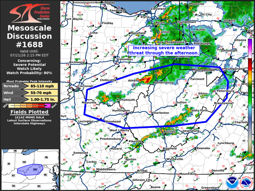
   Areas affected...northeast Kentucky...northern West Virginia...and
   southern Ohio

   Concerning...Severe potential...Watch likely

   Valid 211615Z - 211815Z

   Probability of Watch Issuance...80 percent

   SUMMARY...The severe weather threat will increase this afternoon
   across southern Ohio and northern Kentucky into West Virginia.

   DISCUSSION...A cluster of storms in southeast Ohio will likely
   continue east-southeast into a more unstable airmass along a
   differential heating zone developing across northern West Virginia.
   Damaging winds will likely be the primary threat with this cluster.
   Additional storms are expected to strengthen farther southwest
   through the afternoon with sufficient shear for some supercell
   structures. Damaging winds will likely be the main threat with this
   activity with some large hail potential. In addition, a tornado or
   two is also possible, especially as the low-level jet strengthens
   this afternoon/evening.

   A watch will likely be needed within the next 1 to 2 hours to
   address the threat from the ongoing activity and any additional
   storms which develop.

   ..Bentley/Mosier.. 07/21/2026

   ...Please see www.spc.noaa.gov for graphic product...

   ATTN...WFO...CTP...LWX...RNK...PBZ...RLX...JKL...ILN...LMK...

   LAT...LON   39598231 39898072 39777895 39337864 38837871 38137954
               38018075 37938266 38338420 39078413 39598231

   MOST PROBABLE PEAK TORNADO INTENSITY...85-110 MPH
   MOST PROBABLE PEAK WIND GUST...55-70 MPH
   MOST PROBABLE PEAK HAIL SIZE...1.00-1.75 IN
|
|
|
Top/All Mesoscale Discussions/Forecast Products/Home |
|
Source link