

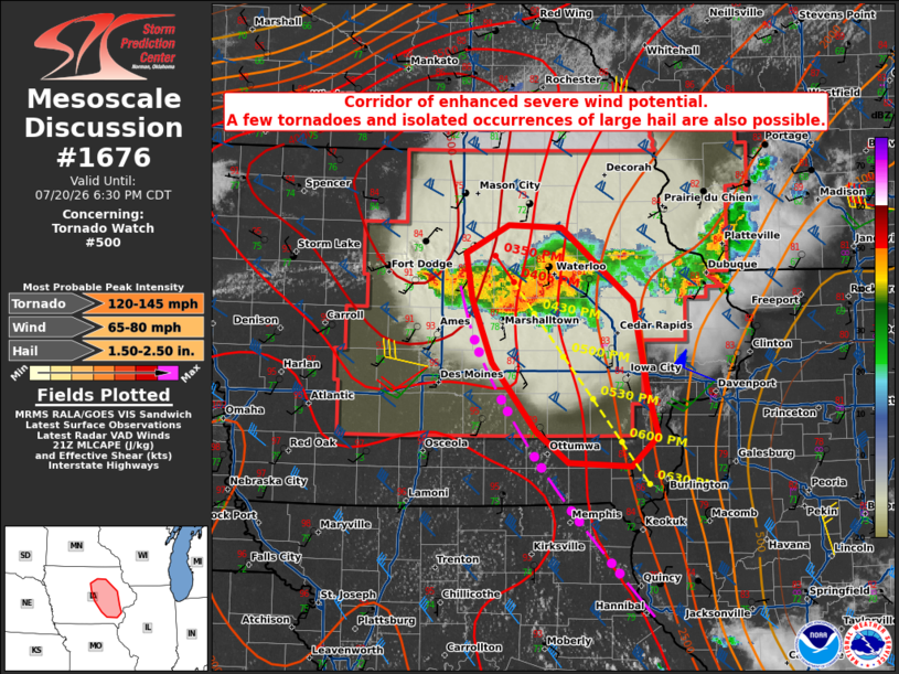
| Mesoscale Discussion 1676 | |
| < Previous MD | |

|
|
Mesoscale Discussion 1676 NWS Storm Prediction Center Norman OK 0434 PM CDT Mon Jul 20 2026 Areas affected...central and eastern Iowa Concerning...Tornado Watch 500... Valid 202134Z - 202330Z The severe weather threat for Tornado Watch 500 continues. SUMMARY...A corridor of enhanced damaging wind potential with gusts of 70-80 mph appears to be evolving from the Waterloo vicinity towards Iowa City. A few tornadoes and isolated occurrences of large hail are also possible. DISCUSSION...Initial more discrete supercells have evolved into a bowing complex with embedded HP supercells near and southwest of Waterloo as of 2125Z. The storm complex is largely situated on the immediate cool side of a north-south-oriented outflow boundary within a zone of locally backed near-surface winds, which are enhancing both low-level and deep-layer shear. Extrapolation of current storm motion and latest WoFS forecasts suggest that a corridor of enhanced damaging wind potential and some tornado risk will spread southeast toward Iowa City over the next 1-1.5 hours. Isolated occurrences of large hail will also be possible given the embedded supercell structures. ..Mead.. 07/20/2026 ...Please see www.spc.noaa.gov for graphic product... ATTN...WFO...DVN...ARX...DMX... LAT...LON 41199253 41769301 42289323 42669330 42899283 42869225 42269147 41559131 41169119 40909149 40949218 41199253 MOST PROBABLE PEAK TORNADO INTENSITY...120-145 MPH MOST PROBABLE PEAK WIND GUST...65-80 MPH MOST PROBABLE PEAK HAIL SIZE...1.50-2.50 IN |
|
|
Top/All Mesoscale Discussions/Forecast Products/Home |
|
Source link