

| Mesoscale Discussion 1655 | |
| < Previous MD Next MD > | |

|
|
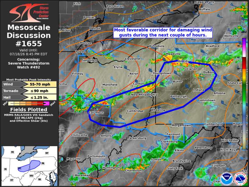
Mesoscale Discussion 1655 NWS Storm Prediction Center Norman OK 0547 PM CDT Sat Jul 18 2026 Areas affected...Parts of western PA and eastern/central OH Concerning...Severe Thunderstorm Watch 492... Valid 182247Z - 190045Z The severe weather threat for Severe Thunderstorm Watch 492 continues. SUMMARY...The most favorable corridor for damaging wind gusts will extend from parts of western Pennsylvania into eastern and central Ohio for the next couple of hours -- within Severe Thunderstorm Watch 492. DISCUSSION...Loosely organized clusters of thunderstorms are tracking southeastward ahead of a cold front extending from western PA into eastern/central OH. The PBZ and CCX VWPs are sampling around 45 kt of west-northwesterly 0-6 km shear oriented perpendicular to the gust fronts of these clusters. This favorable shear orientation and a narrow ENE-WSW-oriented corridor of warm/moist inflow will continue to support damaging wind gusts over the next couple of hours. Thereafter, storms will eventually move southeastward into an air mass that has been overturned by earlier convection (temperatures in the lower 70s in southwestern PA). This should result in a gradual decrease in storm intensity into this evening. ..Weinman.. 07/18/2026 ...Please see www.spc.noaa.gov for graphic product... ATTN...WFO...CTP...PBZ...RLX...CLE...ILN... LAT...LON 40278283 40918053 41448018 41517969 41387850 41087824 40747848 40217950 39638182 39688249 39828290 40058300 40278283 MOST PROBABLE PEAK TORNADO INTENSITY...UP TO 90 MPH MOST PROBABLE PEAK WIND GUST...55-70 MPH MOST PROBABLE PEAK HAIL SIZE...UP TO 1.25 IN |
|
|
Top/All Mesoscale Discussions/Forecast Products/Home |
|
Source link