

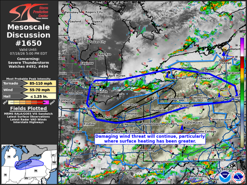
MD 1650 CONCERNING SEVERE THUNDERSTORM WATCH 492…494… FOR LOWER GREAT LAKES VICINITY
Mesoscale Discussion 1650
NWS Storm Prediction Center Norman OK
0228 PM CDT Sat Jul 18 2026

Areas affected...Lower Great Lakes Vicinity

Concerning...Severe Thunderstorm Watch 492...494...

Valid 181928Z - 182100Z

The severe weather threat for Severe Thunderstorm Watch 492, 494
continues.

SUMMARY...The threat for damaging winds will continue, particularly
where surface heating has been greatest. Isolated large hail and
perhaps a tornado will be possible in western New York with
convection near the warm front.

DISCUSSION...Convection within western New York continues to moves
southeast. Stronger cells in the vicinity of Rochester/Buffalo will
pose a threat for isolated large hail and damaging winds. The
tornado threat with these cells is nonzero, but it is conditional on
airmass recovery from the southwest as these cells are within
outflow currently. Small linear segments are also evident farther
southwest within southwestern Ontario. This activity will move
through Lake Erie and eventually impact northeast Ohio into
northwestern Pennsylvania. Temperatures along the lake shore are
nearing 90 F. Wind damage would be possible in these areas over the
next 1-2 hours.

..Wendt.. 07/18/2026

...Please see www.spc.noaa.gov for graphic product...

ATTN...WFO...BGM...BUF...CTP...PBZ...CLE...DTX...

LAT...LON   42608335 42858309 42918171 43367897 43127703 42607570
            42257560 42007603 41867816 41438010 41218192 41318298
            41928350 42608335

MOST PROBABLE PEAK TORNADO INTENSITY...85-110 MPH
MOST PROBABLE PEAK WIND GUST...55-70 MPH
MOST PROBABLE PEAK HAIL SIZE...UP TO 1.25 IN
Source link