

| Mesoscale Discussion 1646 | |
| < Previous MD Next MD > | |
|
|
   Mesoscale Discussion 1646
   NWS Storm Prediction Center Norman OK
   1118 AM CDT Sat Jul 18 2026

   Areas affected...Lower Great Lakes Vicinity

   Concerning...Severe potential...Watch possible

   Valid 181618Z - 181815Z

   Probability of Watch Issuance...60 percent

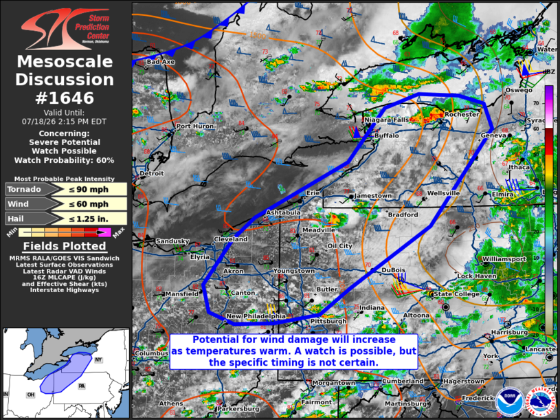
   SUMMARY...Storm intensification is possible early this afternoon.
   Wind damage will be the main risk in the short term. A watch may
   become necessary depending on trends in downstream destabilization.

   DISCUSSION...Convection has developed near the southern shores of
   Lakes Erie/Ontario. This activity is in relatively close proximity
   to the upper-level shortwave trough now moving into Lower Michigan.
   Temperatures in western/central New York have struggled to warm
   significantly due to earlier precipitation and cloud cover. Farther
   southwest, temperatures have already risen into the mid/upper 80s F.
   While storms could potentially produce damaging winds as
   temperatures continue to warm into the afternoon, the downstream
   environment is not currently very favorable. It is probable that it
   will take a few more hours of heating before a more organized severe
   threat can develop along the synoptic cold front. Trends in storm
   coverage/intensity will need to be monitored. Timing for a possible
   watch is the main uncertainty at this time.

   ..Wendt/Thompson.. 07/18/2026

   ...Please see www.spc.noaa.gov for graphic product...

   ATTN...WFO...BGM...BUF...CTP...PBZ...CLE...

   LAT...LON   43467733 43347687 43017673 41757787 40937927 40597980
               40478060 40458129 40608172 40958183 41578133 41868096
               42607931 43317865 43487804 43467733

   MOST PROBABLE PEAK TORNADO INTENSITY...UP TO 90 MPH
   MOST PROBABLE PEAK WIND GUST...UP TO 60 MPH
   MOST PROBABLE PEAK HAIL SIZE...UP TO 1.25 IN
|
|
|
Top/All Mesoscale Discussions/Forecast Products/Home |
|
Source link