

| Mesoscale Discussion 1584 | |
| < Previous MD | |

|
|
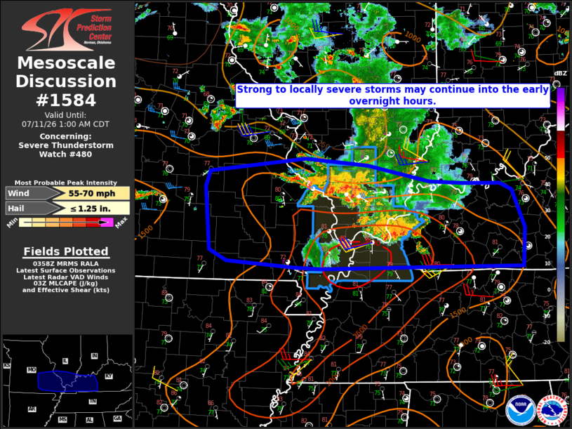
Mesoscale Discussion 1584 NWS Storm Prediction Center Norman OK 1101 PM CDT Fri Jul 10 2026 Areas affected...parts of southeast MO...southern IL/IN...western KY Concerning...Severe Thunderstorm Watch 480... Valid 110401Z - 110600Z The severe weather threat for Severe Thunderstorm Watch 480 continues. SUMMARY...Strong to locally severe storms may continue into the early overnight hours. DISCUSSION...Loosely organized convection is ongoing late this evening from southeast MO into southern IL. Much of the convection across southern IL has become undercut by outflow, though large PW and moderate buoyancy may still support a threat of localized downbursts. There may be some potential for intensification of convection as the composite outflow moves eastward into a very moist environment across western KY. This may result in some wind-damage threat spreading east of WW 480, though weaker deep-layer shear with eastward extent should tend to limit the magnitude of any severe potential. Farther west, elevated convection developing near and just north of a surface boundary across southwest MO may eventually develop or spread eastward into south-central/southeast MO overnight. Modest deep-layer flow/shear should tend to limit storm organization, though localized downbursts and perhaps isolated hail could accompany the strongest storms within this regime. ..Dean.. 07/11/2026 ...Please see www.spc.noaa.gov for graphic product... ATTN...WFO...LMK...PAH...LSX...SGF... LAT...LON 36668969 36699018 36789144 36949177 37869185 38109178 38299001 38198884 37968770 37928708 37928639 37828617 37268595 36698598 36708739 36668969 MOST PROBABLE PEAK WIND GUST...55-70 MPH MOST PROBABLE PEAK HAIL SIZE...UP TO 1.25 IN |
|
|
Top/All Mesoscale Discussions/Forecast Products/Home |
|
Source link