

| Mesoscale Discussion 1579 | |
| < Previous MD | |

|
|
   Mesoscale Discussion 1579
   NWS Storm Prediction Center Norman OK
   0356 PM CDT Fri Jul 10 2026

   Areas affected...portions of northeastern South Dakota into western
   Minnesota

   Concerning...Severe potential...Watch unlikely

   Valid 102056Z - 102300Z

   Probability of Watch Issuance...5 percent

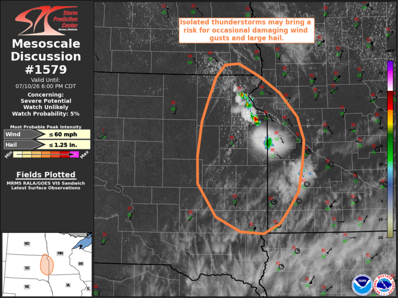
   SUMMARY...Isolated thunderstorms developing along the SD/MN border
   may pose a risk for isolated damaging wind gusts and large hail.

   DISCUSSION...Latest surface analysis places a remnant surface
   boundary extending northwest-southeast across northeastern South
   Dakota and southwestern Minnesota. Isolated, ongoing thunderstorm
   development is noted along this boundary within a bullseye of
   locally greater buoyancy (2000-3000+ J/kg MLCAPE per latest
   mesoanalysis). With only weak to modest effective shear (20-25 kts)
   and mid-level lapse rates less than 7 C/km, convective organization
   and intensity are likely to remain limited overall. Nevertheless,
   steep low-level lapse rates and the aforementioned moderate to
   strong instability may support an isolated risk for damaging wind
   gusts and large hail (with perhaps an instance to 1.5" in diameter
   with the strongest cores). Watch issuance is not anticipated at this
   time owing to the expectation for the severe risk to remain limited
   in magnitude and coverage.

   ..Chalmers/Thompson.. 07/10/2026

   ...Please see www.spc.noaa.gov for graphic product...

   ATTN...WFO...MPX...FGF...FSD...ABR...

   LAT...LON   45899757 46089736 46119707 45919660 45669617 45299579
               44939566 44549570 44149577 43889597 43659617 43499652
               43519702 43749756 44269794 44679796 45229787 45519775
               45899757

   MOST PROBABLE PEAK WIND GUST...UP TO 60 MPH
   MOST PROBABLE PEAK HAIL SIZE...UP TO 1.25 IN
|
|
|
Top/All Mesoscale Discussions/Forecast Products/Home |
|
Source link