

| Mesoscale Discussion 1570 | |
| < Previous MD Next MD > | |

|
|
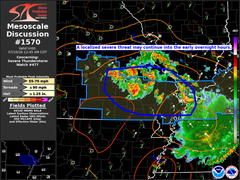
Mesoscale Discussion 1570 NWS Storm Prediction Center Norman OK 1112 PM CDT Thu Jul 09 2026 Areas affected...Parts of southeast MO into extreme southern IL/southwest KY Concerning...Severe Thunderstorm Watch 477... Valid 100412Z - 100545Z The severe weather threat for Severe Thunderstorm Watch 477 continues. SUMMARY...A localized severe threat may continue into the early morning hours. DISCUSSION...Earlier convection has generally become disorganized across southeast MO, though some uptick in storm intensity has been noted near the southern and eastern periphery of the ongoing cluster. Rich low-level moisture, moderate buoyancy, and a modest increase in low-level flow (noted on the KSGF and KPAH VWPs) will continue to support deep convection into the early overnight hours across the region. However, marginal deep-layer shear and the complex/messy storm mode may temper the organized severe threat with time. Until a more definitive weakening trend occurs, localized wind damage and perhaps marginal hail will remain possible. Additional watch issuance is not currently anticipated, though local extension of WW 477 may be considered, if a notable uptick in storm organization occurs prior to the 05 UTC expiration time. ..Dean/Thompson.. 07/10/2026 ...Please see www.spc.noaa.gov for graphic product... ATTN...WFO...PAH...LSX...SGF... LAT...LON 37929193 38049040 37918966 37378885 36928877 36628897 36618944 36639011 36659074 36789131 36959163 37339206 37929193 MOST PROBABLE PEAK TORNADO INTENSITY...UP TO 90 MPH MOST PROBABLE PEAK WIND GUST...55-70 MPH MOST PROBABLE PEAK HAIL SIZE...UP TO 1.25 IN |
|
|
Top/All Mesoscale Discussions/Forecast Products/Home |
|
Source link