

| Mesoscale Discussion 1567 | |
| < Previous MD | |

|
|
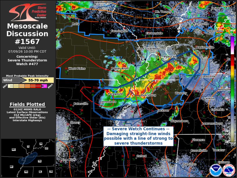
Mesoscale Discussion 1567 NWS Storm Prediction Center Norman OK 0825 PM CDT Thu Jul 09 2026 Areas affected...Portions of southwestern Kentucky into western Tennessee and far eastern Arkansas Concerning...Severe Thunderstorm Watch 477... Valid 100125Z - 100300Z The severe weather threat for Severe Thunderstorm Watch 477 continues. SUMMARY...The threat for severe thunderstorms in WW 477 continues this evening, with storms posing a risk of 55-70 MPH winds. Some local extensions of WW 477 may occur as storms continue east-southeast across the watch area. DISCUSSION...Convection in eastern parts of WW 477 has grown upscale into a linear cluster moving east-southeastward. Steep low-level lapse rates (evident on 00Z BNA sounding) and strong DCAPE in excess of 1200 J/kg will support strong thunderstorm gusts of 55-70 MPH, particularly behind any leading-edge bowing segments. This convection is expected to continue east-southeastward into the evening, and additional local watch extensions may occur in advance of this line. ..Halbert.. 07/10/2026 ...Please see www.spc.noaa.gov for graphic product... ATTN...WFO...OHX...PAH...MEG...LZK... LAT...LON 36149082 36319057 36289015 36398985 36498957 36708909 36878871 37178809 37298768 37068735 36798737 36308784 35898834 35618883 35458932 35408992 35419031 35469062 35649093 36019097 36149082 MOST PROBABLE PEAK WIND GUST...55-70 MPH |
|
|
Top/All Mesoscale Discussions/Forecast Products/Home |
|
Source link