

| Mesoscale Discussion 1565 | |
| < Previous MD | |

|
|
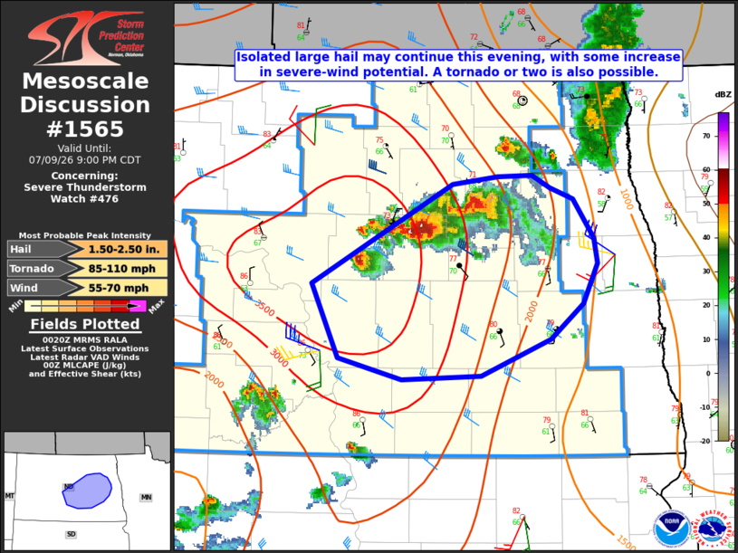
Mesoscale Discussion 1565 NWS Storm Prediction Center Norman OK 0723 PM CDT Thu Jul 09 2026 Areas affected...Parts of central/eastern ND Concerning...Severe Thunderstorm Watch 476... Valid 100023Z - 100200Z The severe weather threat for Severe Thunderstorm Watch 476 continues. SUMMARY...A threat for isolated large hail will continue into the evening, along with some increase in severe-wind potential. A tornado or two is also possible. DISCUSSION...A few semi-discrete supercells are moving southeastward across central/northeast ND early this evening. MLCAPE of 2500-3500 J/kg and moderate deep-layer shear will continue to support supercells through the early evening, with large to locally very large hail possible. Some southeastward acceleration has recently been noted with this supercell cluster, which may be indicative of an expanding cold pool. Any further upscale growth could result in an increasing severe-wind threat as storms spread southeastward. Also, while low-level flow is not particularly strong, modest low-level veering (as noted in the KBIS VWP) and presence of sustained supercell structures could also support potential for a tornado or two. ..Dean.. 07/10/2026 ...Please see www.spc.noaa.gov for graphic product... ATTN...WFO...FGF...BIS... LAT...LON 47290085 48099921 48149868 48159828 48069808 47969780 47659757 47469752 47149770 46859807 46579889 46549980 46710054 47290085 MOST PROBABLE PEAK TORNADO INTENSITY...85-110 MPH MOST PROBABLE PEAK WIND GUST...55-70 MPH MOST PROBABLE PEAK HAIL SIZE...1.50-2.50 IN |
|
|
Top/All Mesoscale Discussions/Forecast Products/Home |
|
Source link