

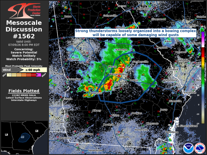
| Mesoscale Discussion 1562 | |
| < Previous MD | |

|
|
   Mesoscale Discussion 1562
   NWS Storm Prediction Center Norman OK
   0529 PM CDT Thu Jul 09 2026

   Areas affected...Central and Eastern Georgia

   Concerning...Severe potential...Watch unlikely

   Valid 092229Z - 100000Z

   Probability of Watch Issuance...5 percent

   SUMMARY...A loosely organized line of strong to severe thunderstorms
   will pose a short-term risk for damaging wind gusts before weakening
   this evening. Weather watch issuance is not anticipated at this
   time.

   DISCUSSION...A line of strong to severe thunderstorms has loosely
   organized along the leading edge of its combined outflows. These
   storms will be capable of intermittent severe wind gusts approaching
   60 MPH, but are expected to diminish heading into the evening.
   Recent radar trends and HRRR-based mesoanalysis show the convective
   complex moving into an area of rain-cooled air and greater MLCINH,
   suggesting that the available buoyancy for these storms is
   short-lived. Given these factors, weather watch issuance is not
   anticipated at this time.

   ..Halbert/Thompson.. 07/09/2026

   ...Please see www.spc.noaa.gov for graphic product...

   ATTN...WFO...CHS...CAE...FFC...TAE...

   LAT...LON   31918387 32198398 32518377 32708354 32888345 33088339
               33248312 33318270 33188231 32998201 32838181 32438207
               31948262 31848317 31918387

   MOST PROBABLE PEAK WIND GUST...UP TO 60 MPH
|
|
|
Top/All Mesoscale Discussions/Forecast Products/Home |
|
Source link