

| Mesoscale Discussion 1555 | |
| < Previous MD | |

|
|
   Mesoscale Discussion 1555
   NWS Storm Prediction Center Norman OK
   0105 PM CDT Thu Jul 09 2026

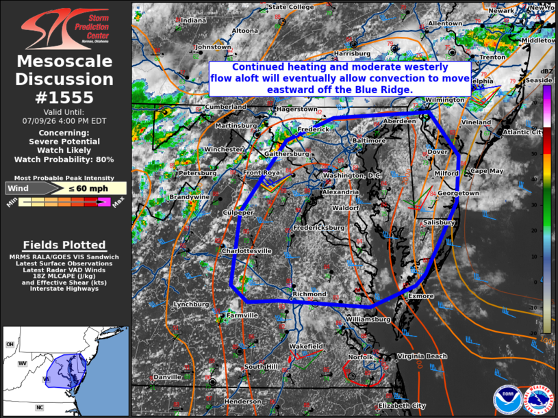
   Areas affected...Parts of central central/northern Virginia into
   southern Maryland

   Concerning...Severe potential...Watch likely

   Valid 091805Z - 092000Z

   Probability of Watch Issuance...80 percent

   SUMMARY...Damaging wind gusts are possible as convection continues
   to intensify and move eastward this afternoon. A watch is likely.

   DISCUSSION...Convection along a stationary boundary has shown modest
   intensification over the last hour near the MD/PA border. Additional
   convection is developing along the Blue Ridge. Sufficiently strong
   westerly winds across the Ridge will eventually move convection to
   the east. Furthermore, around 30 kt of effective shear will be
   present allowing for stronger storm cells and linear structures.
   Low-level lapse rates will continue to steepen this afternoon,
   though cloud cover has been greater in the vicinity of the
   Chesapeake Bay. Given the potential for one or more clusters to
   evolve this afternoon, a watch is likely to address the threat for
   damaging wind gusts.

   ..Wendt/Hart.. 07/09/2026

   ...Please see www.spc.noaa.gov for graphic product...

   ATTN...WFO...PHI...AKQ...LWX...RNK...

   LAT...LON   37517807 37697831 38537820 39337755 39597685 39657547
               39157505 38637508 37837554 37697569 37457634 37537764
               37517807

   MOST PROBABLE PEAK WIND GUST...UP TO 60 MPH
|
|
|
Top/All Mesoscale Discussions/Forecast Products/Home |
|
Source link