

| Mesoscale Discussion 1554 | |
| < Previous MD | |

|
|
   Mesoscale Discussion 1554
   NWS Storm Prediction Center Norman OK
   1242 PM CDT Thu Jul 09 2026

   Areas affected...Lower Ohio Valley

   Concerning...Severe potential...Watch possible

   Valid 091742Z - 091945Z

   Probability of Watch Issuance...40 percent

   SUMMARY...A risk for damaging winds will evolve from eastward moving
   outflow in the lower Ohio Valley. The coverage of strong/severe
   storms is not clear, but a watch is possible this afternoon. Trends
   will be monitored.

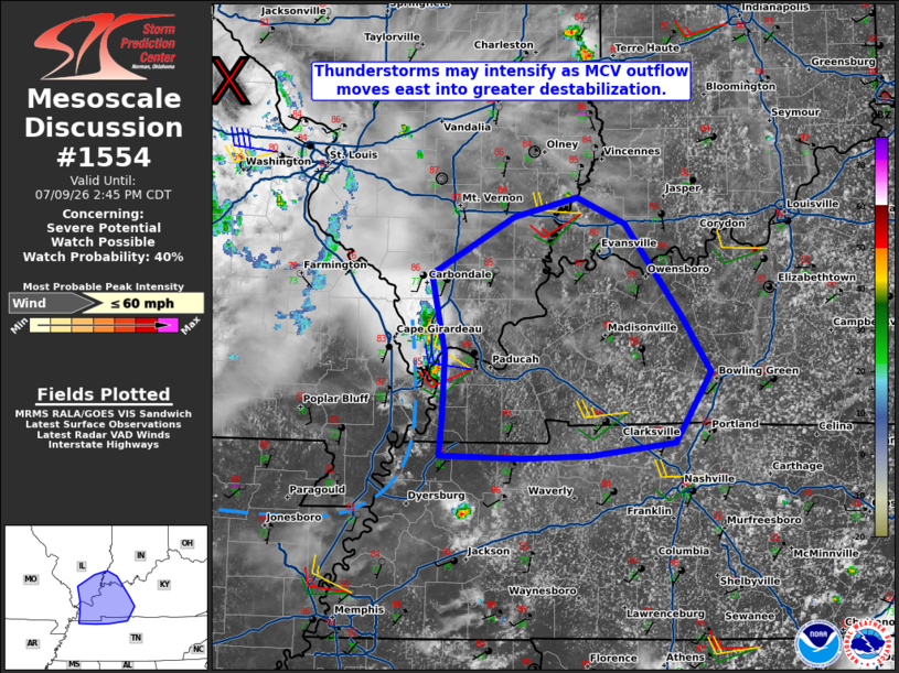
   DISCUSSION...Outflow from convection associated with an MCV
   northwest of St. Louis is moving eastward into the lower Ohio
   Valley. As this boundary moves into an increasingly unstable airmass
   with strong heating and mid/upper 70s F dewpoints, some
   intensification is possible. The main risk for damaging winds will
   likely occur south of the cirrus plume from the MCV. With the MCV
   displaced to the northwest, shear/forcing enhancement will be
   minimal. The degree of damaging wind threat will be tied to how
   organized convection along the outflow boundary becomes. A watch is
   possible if convective trends warrant.

   ..Wendt/Hart.. 07/09/2026

   ...Please see www.spc.noaa.gov for graphic product...

   ATTN...WFO...LMK...OHX...PAH...MEG...

   LAT...LON   36408908 36718904 37188902 37788916 38238836 38388777
               38178731 37468677 37038649 36508682 36398764 36378829
               36408908

   MOST PROBABLE PEAK WIND GUST...UP TO 60 MPH
|
|
|
Top/All Mesoscale Discussions/Forecast Products/Home |
|
Source link