

| Mesoscale Discussion 1502 | |
| < Previous MD | |

|
|
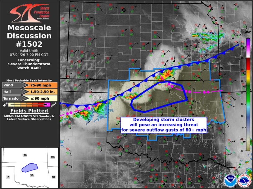
Mesoscale Discussion 1502 NWS Storm Prediction Center Norman OK 0534 PM CDT Sat Jul 04 2026 Areas affected...North central and northwest Oklahoma Concerning...Severe Thunderstorm Watch 460... Valid 042234Z - 050000Z The severe weather threat for Severe Thunderstorm Watch 460 continues. SUMMARY...Developing storm clusters will pose an increasing threat for severe outflow gusts of 80+ mph into this evening while spreading southeastward. DISCUSSION...Two storm clusters have developed - one near the outflow/front intersection in southern KS and another along the front in northwest OK. New storm development may also occur along the front between the two, with a larger cluster possibly evolving through late evening. Deep-layer shear is sufficient for supercells, especially along the residual outflow boundary in northern OK. The environment downstream from these clusters appears favorable for hybrid microbursts with deep inverted-V profiles and large buoyancy with hot surface temperatures and sufficient moisture to keep storms going into early tonight. Deep-layer vertical shear will be sufficient for some cluster organization. As a result, the potential for severe outflow gusts is expected to increase through 00z in northwest and north central OK, where a few gusts could exceed 80 mph. Additionally, the strongest/embedded supercells will be capable of producing large hail in the 1.5-2.5 inch diameter range. ..Thompson.. 07/04/2026 ...Please see www.spc.noaa.gov for graphic product... ATTN...WFO...TSA...OUN... LAT...LON 36979713 36809647 36619636 36249622 36139678 36009733 35769826 35859874 36049890 36249883 36649812 36939756 36979713 MOST PROBABLE PEAK TORNADO INTENSITY...UP TO 90 MPH MOST PROBABLE PEAK WIND GUST...75-90 MPH MOST PROBABLE PEAK HAIL SIZE...1.50-2.50 IN |
|
|
Top/All Mesoscale Discussions/Forecast Products/Home |
|
Source link