| Mesoscale Discussion 1354 | |
| < Previous MD | |

|
|
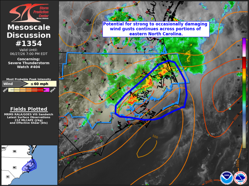
Mesoscale Discussion 1354 NWS Storm Prediction Center Norman OK 0459 PM CDT Sat Jun 27 2026 Areas affected...portions of eastern North Carolina Concerning...Severe Thunderstorm Watch 404... Valid 272159Z - 272300Z The severe weather threat for Severe Thunderstorm Watch 404 continues. SUMMARY...The potential for occasionally damaging wind gusts continues across portions of Severe Thunderstorm Watch 404, including eastern North Carolina. DISCUSSION...Ongoing thunderstorm activity has congealed into a convective cluster extending from near New Bern, NC, into the northern Outer Banks, with a couple of wind gusts measured in the 40-45 mph range over the past 1-2 hours. While weak effective shear (generally 25 kts or less) will continue to limit storm organization, around 1500-2000 J/kg MLCAPE and a very moist air mass (PWAT values of 2+ inches) will continue to promote water-loaded downdrafts capable of strong to occasionally damaging wind gusts as this cluster progresses eastward before eventually moving offshore. Locally greater potential may exist along the northern portions of the cluster where the latest objective analysis suggests that mid-level flow and effective shear are marginally greater. ..Chalmers.. 06/27/2026 ...Please see www.spc.noaa.gov for graphic product... ATTN...WFO...AKQ...MHX... LAT...LON 35137539 35107546 35037567 34937591 34857606 34817627 34797662 34857705 34877738 34957753 35167752 35457723 35847668 36257615 36377581 36317562 36127547 35827528 35457523 35127532 35137539 MOST PROBABLE PEAK WIND GUST...UP TO 60 MPH |
|
|
Top/All Mesoscale Discussions/Forecast Products/Home |
|
Source link