
In brief: Today’s post focuses primarily on recapping the Gulf Coast flooding from last week, with a look at why Arthur was a contributor but not the only cause of the flooding. We also argue that had Arthur not technically been a tropical storm, the outcome would likely have still been similar.
Tropics
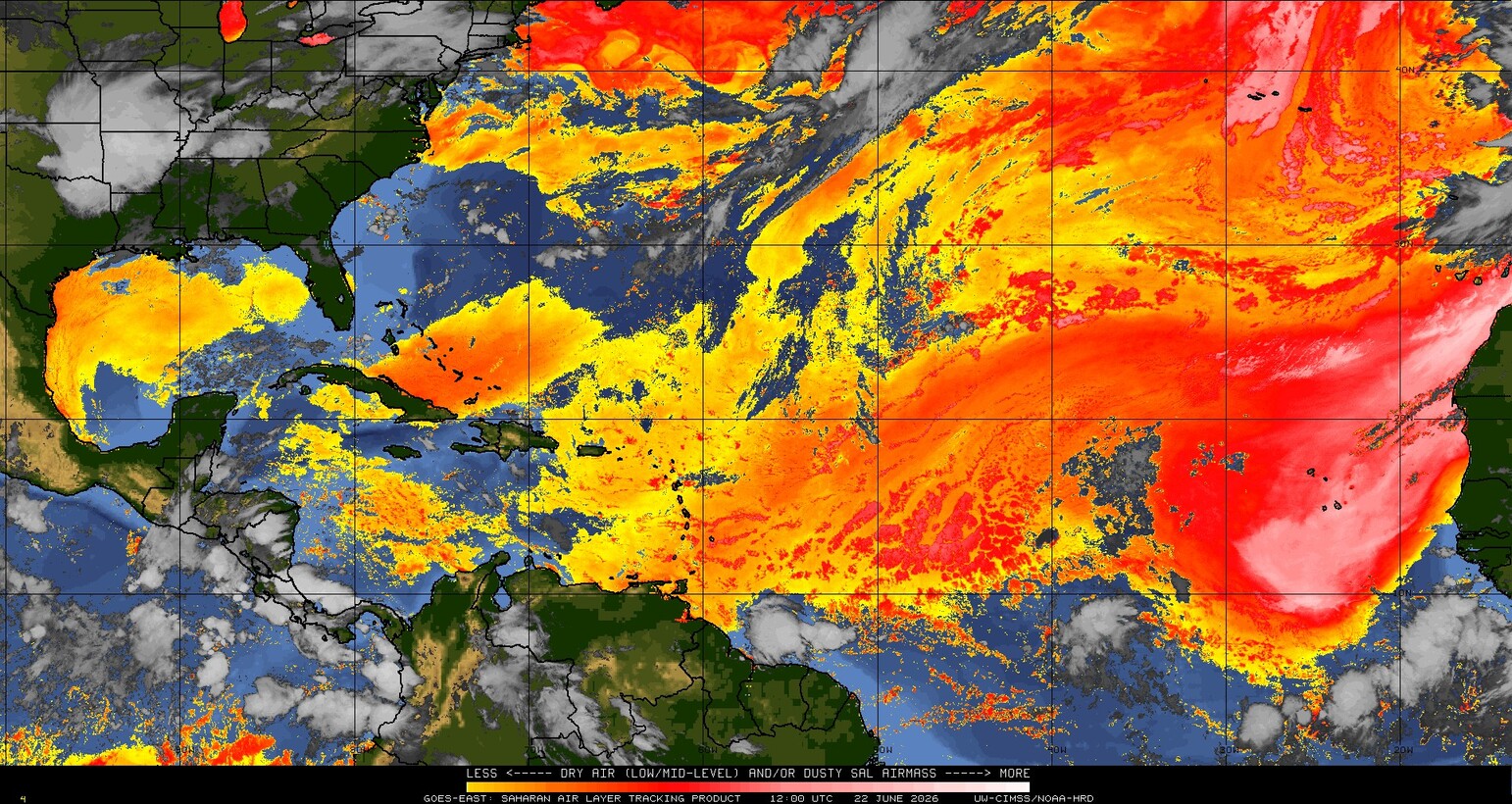
Nothing to do. It’s quiet out there, and it looks to stay that way over the next 7 to 10 days. The Atlantic, as it often is this time of year, is caked in dust.
So at this time, there’s nothing expected. We still expect a below average season overall, but it’s fairly common for the end of June and front half of July to struggle with much tropical activity. So this is not abnormal in the grand scheme of things and doesn’t indicate anything of note heading out beyond the forecast horizon.
Recapping rain
The Gulf Coast is a tough place to live sometimes. There’s a lot of socioeconomic history involved there, but from a weather perspective almost every weather event seems to be magnified.
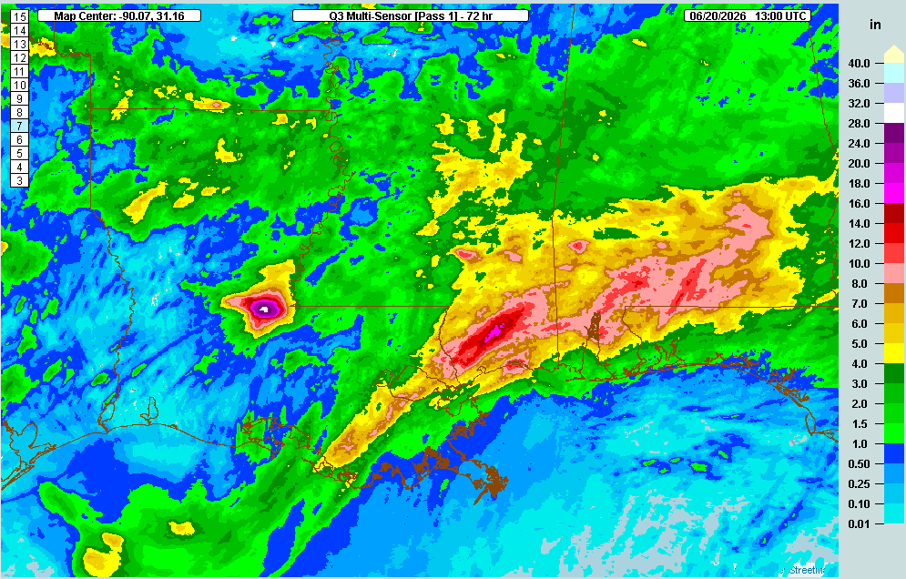
Avoyelles Parish, Louisiana is the most recent victim of magnified weather, as last week’s rains from the remnants of Arthur and a water-fueled jet stream pattern dumped 2 feet of rain on a good chunk of the Parish. This caused extensive flooding, dozens of rescues, and another chapter in a long, storied flood history in Louisiana. For those looking to contribute to relief, Building a Better Avoyelles is a local charity helping with flood relief now. The United Way of Central Louisiana is also another local organization that can help. The usual suspects are also fine organizations as well, but I wanted to focus on local support here. Feel free to leave other sources in the comments.
Avoyelles Parish residents can’t really recall anything this bad there in memory. The flooding was not limited to just there, however. Southern Mississippi also took a big hit, with areas north of Gulfport and Biloxi seeing as much as 17 to 18 inches of rain.
How rough have the last 7 to 10 or so days been in the South? Rough.

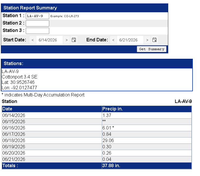
Plaucheville, LA ended up with 31.51 inches over the course of last week. Perkinston, MS had 21.53 inches of rain. Red Level, AL saw 12.60 inches. A CoCoRaHS station at Cottonport, LA saw over 37 inches of rain as well. Wiggins, MS was 22.84 inches.
Beyond damage and totals, it’s important to remember that while Tropical Storm Arthur played a role in this, we would have had a substantial rain and flooding event still, even without Arthur. We had been talking about this for several days before the event itself. You can see this show up when we look at the European model’s precipitable water analysis image from last Thursday morning.
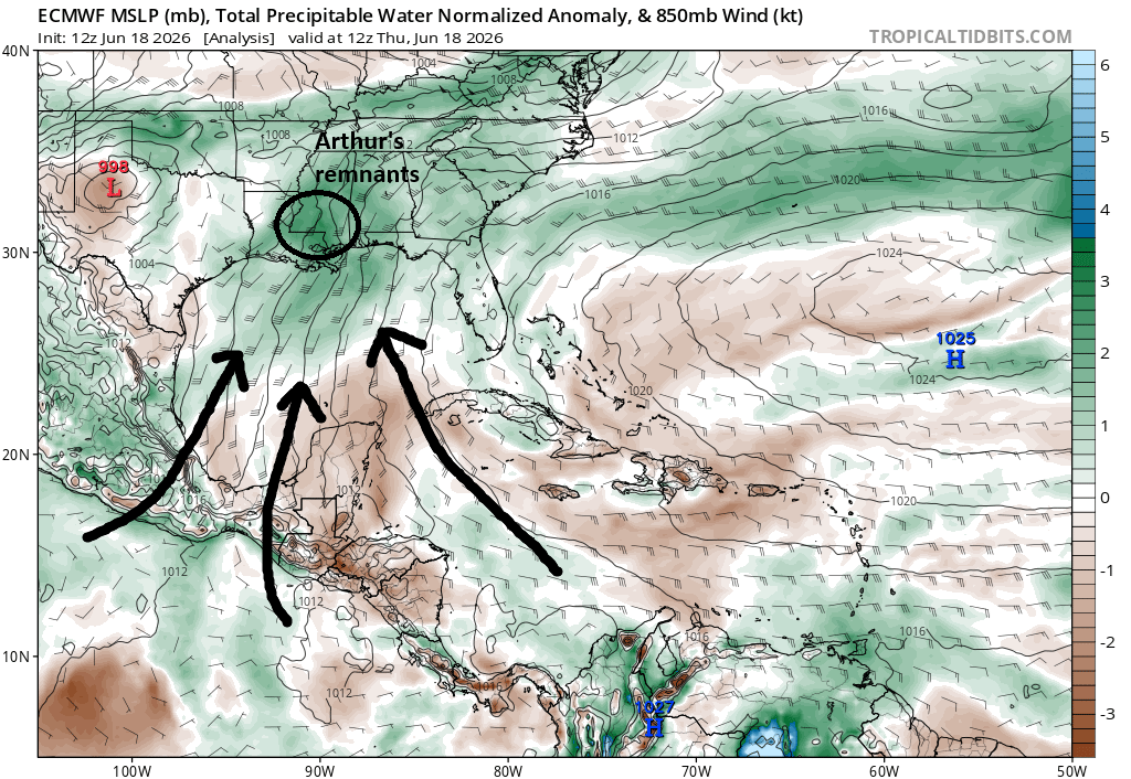
What is this showing? Well, for one, Arthur shows up progressing through Louisiana and Mississippi. But beyond that, you have Caribbean moisture and Pacific moisture converging across the Gulf. Remember, Pacific Ocean water temperatures are outlandishly warm, and not just because of El Niño either. What’s coming out of the Pacific is record warm.
Keep in mind that even if Arthur never technically became a tropical storm, it was indicative of a vigorous disturbance that may have also been influenced by Pacific Tropical Storm Cristina, which weakened about week before Arthur formed. I would argue that Arthur would have been about the same intensity and rain-laden had it never even made it over the water.
So it raises a valid question that my friend and colleague Michael Lowry lobbed out there, which is whether this may have confused the issue somewhat. Messaging a tropical storm and messaging a flood are occasionally one in the same, as tropical storms can and often do produce flooding. But did the idea that Arthur developed and made landfall in Texas so quickly maybe suggest that areas farther east were off the hook? The NHC’s job is to follow the science with respect to naming storms. If it’s a tropical storm, then it’s a tropical storm, and they should not ignore that just because it may alter perception in some places. (We can argue whether Arthur was indeed a tropical storm or something more hybrid, and we’ll see what the postseason analysis says) But in this case, it had been broadcast for days in advance that serious flooding potential was coming to the Gulf Coast. So no one should have been caught off guard, per se. (Though seeing nearly 30 inches in a day in Avoyelles Parish is tough to really argue was “expected.”)
At any rate, the takeaway here: Focus on the threats, not the technicalities. Just because it looks like a duck and quacks like a duck doesn’t mean you won’t get a goose or a swan too.
Source link